Homefront Wargame Center

…supporting our hobby!

Archive for the ‘HFC On Tour’ Category

Visiting Battlefields: The Battle of Tolbiac

Posted by Denny Koch on June 20, 2015

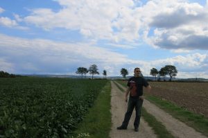
The battlefield

The battlefield

It’s time for a new “Vising Battlefields” report!

This time, we didn’t travel the Ardennes or visited another WWII battle site (which was the focus of our previous battlefield tours), but we traveled far back in time into the year 496 AD.

We were on our way to the city of Zülpich (once a Roman vicus named “Tolbiacum“, dating back to the 1st century BC) to visit the Roman thermae (baths), which are still in excellent shape and very well presented in the “Museum of Bathing Culture”.

On our way through the plains of the Zülpicher Börde – an area strongly dominated by agriculture and the Rhenish brown coal fields -, we came upon a large field with a striking granite stele. This stirred our interest and we pulled over to investigate the place. Close to the country road was a bronze plate and we learned that this was the original site of the Battle of Tolbiac, the famous battle of Clovis I (German: Chlodwig I) and his Franks against the combined tribes of the Alamanni (whose leader is unknown).

This was one of the decisive battles in late antiquity because it was the main reason why the Franks converted to Christianity – thus opening the way for Charlesmagne and his deep impact on European history some centuries later. Clovis’ victory led to the foundation of the Merovingian Frankish Empire.

The Location

The battlefield is located between the villages of Langendorf and Wollersheim North of Bundesstraße (Federal Highway) 256, close to Zülpich and about 60 km East of the German-Belgian border.

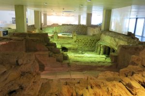
The public baths in the Roman city of Tolbiacum

The public baths in the Roman city of Tolbiacum

Zülpich, or Tolbiacum, was located in the Roman province of Germania inferior at an important Roman crossroads – similar to the Belgian town of Bastogne – because all major Roman roads met here: The Via Agrippa, connecting Trier (Augusta Treverorum, the second largest city in the Roman Empire, therefore also called Roma Secunda) with Cologne (Colonia Claudia Ara Agrippinensum), as well as roads to the Lower Rhine to Xanten (Colonia Ulpia Traiana) via Neuss (Novaesium), to Bonn (Bonna) and Jülich (vicus Iuliacum).

Because of its strategical and logistical importance, Tolbiacum flourished during Roman times and was an important location for hostels, horse changing stations and trade. The public baths (Thermae) were very luxurious, especially in these remote parts of Germania inferior. Today, they are among the best preserved Roman baths North of the Alps and well worth a visit!

During the 5th century, the entire region suffered under repeated German invasions where German tribes from the areas East of the Rhine raided the cities and villages of the Western provinces. Eventually, Rome withdrew from this area, and combined German tribes advanced into these lands (which were originally inhabited by a local Celtic population like the Eburoni, who were eradicated by Iulius Caesar during the Gallic War, or the Treveri, who dominated the areas between the Eifel, Moselle, and Ardennes region for centuries) as well as Rome-loyal Germanic tribes like the Ubii.

The Battle of Tolbiac

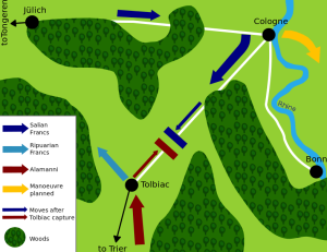
Map of the Battle of Tolbiac

Map of the Battle of Tolbiac

The year of the Battle of Tolbiac (German: Schlacht von Zülpich) is not undisputed – most sources date it back to the year 496 AD, but there are also sources which claim that the Battle was fought in 506 AD. The battle is also known as the “Battle of Conversion” (German: Bekehrungsschlacht).

It was fought between the united Ripuarian Franks (led by Sigibert of Cologne) and Salian Franks (led by Clovis I) against the attacking Alamanni, a confederation of several Germanic tribes. Since the Alamanni repeatedly raided the lands of Sigibert, he eventually called on Clovis I for help.

It was the second battle of Clovis I against the Alamanni forces; the third battle in Straßburg eventually led to the end of the Alamanni Empire.

Whether the plains near Zülpich were the actual battle site is also disputed; some researchers claim that the location was too far in the North for the Alamanni. Others argue that the Alamanni used the old Roman highways between Metz, Trier, and Cologne for their attacks against the Franks (who were also in conflict with the Visigoths under Alarich II at this time, so that the Alamanni probably considered them to be a weakened target). So Zülpich, as a Roman crossroads town, was likely on their route.

The

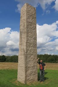
The “Chlodwig-Stele” marks the battlefield site

Not much is known about the battle, except that the Ripuarian Franks suffered heavy losses.The main account of the battle was written down by Gregory of Tours,  a Gallo-Roman historian, bishop of Tours and leading prelate of Gaul. He is considered to be the main source for Merovingian history.

The battle was desperate, and finally Clovis I began to pray to the Christian God – the God of his wife Clotilde – after his gods apparently didn’t answer. His prayer was quite pagan, though: according to heathen custom of “do ut des” (“I give, so that You will give”), he made a special deal with the Christian God: if the Franks were victorious in this battle, he would convert to Christianity and let himself be baptized.

According to Gregory of Tours, the Alamanni leader was killed by an axe just in the same moment, and the remaining Alamanni fled the battlefield. The Franks followed them, killing the fleeing Alamanni until they surrendered.

This story closely resembles the conversion of Constantine the Great during the Battle of the Milvan Bridge.

After their defeat, the Alamanni left the Ripuarian kingdom and withdrew to the South. Clovis I respected the Ripuarian claim on the territory, but demanded their assistance in fights against the Visigoths later in return for their help against the Alamanni.

Conversion of the Franks

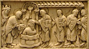
Clovis I delivered on his promise. He was baptized in Reims on Christmas in 496 AD (this date was firmly attested by Gregory of Tours and in a letter by Avitus of Vienne who congratulated Clovis on his baptism).

The baptism of Clovis

The baptism of Clovis

In contrast to the Romans, where conversion or belief in a specific deity was a personal matter, the conversion of the Germanic leader had impact on his entire tribe, so his men soon followed their king’s example.

Since Clovis I converted to the orthodox Athanasian Catholicism (in contrast to most other Germanic tribes who followed the Arianian Catholicism), the Franks seamlessly coexisted with the local Gallo-Roman inhabitants and the local clergy, who also were Athanasian Christians. This eventually led to assimilation and peaceful merging of the Franks with the local population. It also empowered Clovis I to undertake crusades against the Arian Christians (who were considered heretics) and to Christianize and so win new territory, so his conversion to Christianity was tied to a strong gain in power – and he certainly never regretted his conversion on the battlefield… this God had certainly delivered 😉

Visiting the Battlefield today

Since the battlefield is located in a rural area, you can simply park your car next to the field. There are no signposts, but you cannot overlook the granite stele which is widely visible from the highway.

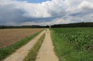
A small path leads across the battlefield

A small path leads across the battlefield

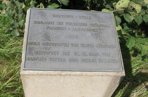
A footpath across the field leads to the granite stele, which serves as a Memorial of the battle. A bronze plate contiguous to the road informs about the site (and the stele) – unfortunately, the text is only in German. It reads: “Clovis stele. Battle near Tolbiacum (Zülpich), Franks vs. Alamanni 496. Stele created by Ulrich Rückrieh, donated on September, 18th, 1999 by Manfred Vetter and Henrik Hanstein”.

As the text suggests, the stele was built by sculptor Ulrich Rückrieh, who also built more steles around the city of Düren. The Clovis stele, which is made of solid granite, is several meters high. It was gifted to the city of Zülpich by the “Manfred Vetter charity foundation for Arts and Culture” and financed by Professor Hanstein, who paid a symbolic price of 100,000€ for the monument with one condition: The money had to be spent for a specific purpose – for the installation of the Museum of Bathing Culture, thus for the conservation and presentation of the ancient Roman baths of Tolbiacum.

The bronze plate

The bronze plate

So the granite monument contributed to the preservation of the Roman heritage of Tolbiacum while serving as a memorial on a battlefield site – a good deal!

The entire area of Eastern Gaul / Germania inferior is full of Roman heritage sites, temples (especially for the Gallo-Roman Matronae, but also temples for Mercury, Apollo-Grannus, Lenus-Mars, Sirona, Epona etc.), Roman industrial sites like millstone quarries, iron smelting factories, civilian sites like baths, villages, villae rusticae (Roman rural estates), and last but not least, military sites like castles, forts, and fortifications. So traveling around western Germany and visiting Gallo-Roman places is a worthwhile alternative or addition to visiting WWII sites and highly recommend!

Some of these places are UNESCO world heritage sites, and many are among the best preserved or largest North of the Alps.

Wargame?

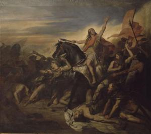
The Battle of Tolbiac in a 19th century painting by Ary Scheffer

The Battle of Tolbiac in a 19th century painting by Ary Scheffer

The battle of the Franks under Clovis I against the Alamanni was a key moment in European history and the beginning of the rapid spreading of Christianity all over Europe.

Our question to our readers:

Does anyone know of a wargame or scenario about this decisive Battle of Tolbiac? Since there isn’t much knowledge about the battle, the size of the participating armies or even the name of the Alamanni leader, it’s certainly difficult to design a game of this battle (at least without improvising or without assumptions and well-educated guesses about how this battle would have been like). But nevertheless, there are so many wargames about exotic and unknown battles, for example in magazines or published by companies like SPI, who were not fazed by uncommon locations and eras, that there may be a small chance!

If you know of a wargame or (scenario within a game series) dealing with this specific battle (or, on a larger scale, of the battles between Franks / Alamanni / Visigoths in the 5th, early 6th century), leave us a comment!

Posted in HFC On Tour, Historical Sites, Visiting Battlefields | Tagged: , , , , , , , , , , , , | 1 Comment »

HFC On Tour: Battle of the Bulge – Bastogne and the Ardennes II

Posted by Denny Koch on July 17, 2013

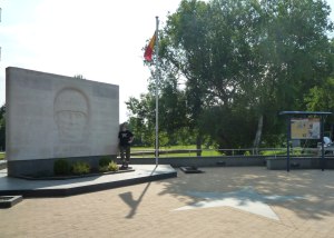
Bastogne: Mardassone Memorial

Bastogne: Mardassone Memorial

Last year, we toured the Eastern Ardennes in Luxembourg and Eastern Belgium, visiting famous locations like Clervaux, St Vith, Ettelbrück, and Diekirch.

This year, we set up base camp in one of the most important (and certainly the most famous) locations of the Battle of the Bulge: in Bastogne.

From there, we visited places like Foy with the Easy Company foxholes, Recogne, Houffalize, and La Roche-en-Ardenne, where the US troops joined forces with the Scottish Highland Division.

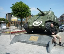
Bastogne: Place General McAuliffe with Sherman tank and McAuliffe bust

Bastogne: Place General McAuliffe with Sherman tank and McAuliffe bust

All over the area, you can find relics and reminders of the Battle of the Bulge – memorials, museums, and even traces of combat still visible on the battlefields. This combined with the impressive landscape of steep rocky valleys, soft rural hills, dense woods, and tiny villages, the Belgian Ardennes are well worth a trip!

Please check out our photo gallery for MANY MORE photos!!

Bastogne

Despite the fact that there are certainly more picturesque places in the Ardennes, we decided to stay in a hotel in the noisy and congested crossroads town of Bastogne, which is situated on a ridge at an altitude of 510 m.

The strategical importance of this small city (about 14,000 inhabitants) lies in the fact that all roads within the Ardennes lead to and through Bastogne. This was the main reason why both sides were fighting desperately to get control over the city – who controls Bastogne, controls the road network of the entire region.

The same is still true today – and this is the reason why Bastogne can certainly be considered to be the traffic capitol of the Ardennes. The layout of the city is simple: one main road (with shops, bars, church), one giant parking space in the central square, surrounded by bars and restaurants, and a central crossroads with numerous roads leading out in all directions, reminding us of a spider’s net. A never-ending stream of cars rushes through the streets all day long, so Bastogne is easily the noisiest and busiest places in the quite and peaceful Ardennes.

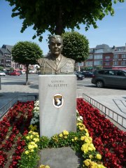
Bastogne: General "Nuts!" McAuliffe

Bastogne: General “Nuts!” McAuliffe

Bastogne then…

Bastogne was captured by US forces in December 1944 and a strong perimeter around the city was built.

On December 20th, 1944, German forces under the command of Lt. General Freiherr von Lüttwitz managed to bypass Bastogne and encircle it. The besieged city was held by the 101st Airborne Division under the command of Brigadier General McAuliffe and elements of the 10th Armor Division, which were outnumbered by surrounding German forces 5-1. The situation in the besieged city was rough because medical supplies, food, and ammunition were soon running low. In addition, winter 1944 was one of the coldest winters ever recorded with temperatures dropping as low as -28°C / -18.4 F and the soldiers where not properly equipped with cold-weather-gear. In the beginning, there was no hope for air support or supply by air because of the bad weather.

Over the following days, the weather cleared and the Allies eventually managed to supply the surrounded soldiers by air drops. The Germans attacked the town relentlessly, but didn’t manage to break the defense line. This was frustrating for German command, so finally German commander von Lüttwitz requested the surrender of the forces in Bastogne. McAuliffe’s response was simple – and consisted of only one word: “Nuts!” (which can be roughly translated into German with: “Ihr spinnt wohl!”).

On December 26th, two of the German besieging forces where commanded to press forward and leave Bastogne behind, so that the only attackers left where Panzer Lehr’s 901st regiment and the 26th Volksgrenadier Division. Since both of these units where ill supplied and near to exhaustion, they were not able to continue the attack on Bastogne from all sides, but were limited to small assaults on certain points here and there. This wasn’t very effective, so in the end, the US forces managed to destroy all enemy tanks. On December 26th, the city was liberated by General Patton’s 4th Armor Division and a corridor to the Allied controlled parts of the Ardennes was opened.

Crossroads town Bastogne is certainly the noisiest and busiest place in the Ardennes

Crossroads town Bastogne is certainly the noisiest and busiest place in the Ardennes

…and Bastogne now

As mentioned before, Bastogne is still a crossroads town. The central square “Place General McAuliffe” was transformed into a giant parking lot. There is a tourist information next to the main road which almost exclusively sells war souvenirs – you can get anything from mugs, key rings, t-shirts with a “Nuts!” logo, posters, caps, postcards related to Bastogne, the USA, the 101st Airborne, and the Battle of the Bulge.

At the edge of the parking lot is a Sherman tank (which is the main tourist attraction and very famous among kids who love climbing on top of the tank) and a bust of General McAuliffe. The parking lot is surrounded by bars and restaurants of mixed quality.

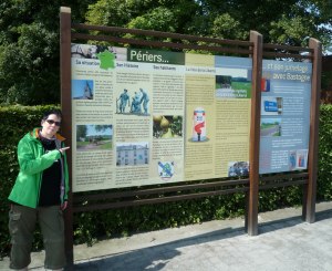
Bastogne is located in the francophone part of Belgium, in Wallonie, so the dominant language is French. We made the experience that many locals only speak rudimentary English (if at all), so knowing at least some basic French expressions is highly recommended (and much appreciated by the locals). Many information boards and signs are in French only, in rare cases with a Flemish and sometimes with an English translation. Luckily, at least some information boards regarding the Battle of the Bulge are multilingual.

014_Bastogne

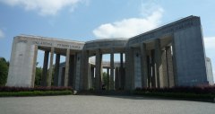
War Memorial at the Main Street

Despite the fact that there are lots of hotels in Bastogne as well as many restaurants, it isn’t the typical “tourist town” – we rarely saw any tourists at  all and in the evening, we were almost exclusively among Belgians. Most battlefield tourists probably stay in one of the many beautiful and idyllic Ardennes villages, which are much more catered to tourism, with higher quality restaurants and bars.

Since everything in the Ardennes is in close proximity to each other, it doesn’t really matter where you set up your base camp. Last year’s Clervaux was perfect because it is probably the most central town in the Ardennes with everything within a 30 km radius (including Bastogne). If we had known how beautiful La Roche is, we probably would have booked a hotel there. Wiltz is also a very nice town with many cultural highlights.

The Main Street

The Main Street

But so we had the chance to make the curious experience of spending several nights in Bastogne, which was at least interesting, if not very relaxing, due to the constant traffic and the ugly parking lot which comprises the city center. At least there’s no problem to find a place for your car, but we had a car-house rented for our Mercedes because we remembered our experience in Arnhem, where all places to park your car cost 2,50 € per hour and parking spaces were limited.

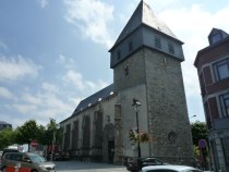
In addition to everything related to the Battle of the Bulge, other touristic sights include the annual bicycle race Liège – Bastogne, the museum en Piconrue (a museum about religious art and popular belief in the Ardennes) and Eglise St Pierre, a Gothic church with a Romanic bell tower. The three bells were donated by veterans of the 101st Airborne, German Fallschirmjäger Regiment, and the Anciens Combattants de Bastogne to commemorate the destruction of  Bastogne in 1944.

You can get a city map for free in the tourist information with the location of all relevant sites in and around Bastogne and the staff will gladly give you directions.

Church St Pierre

Church St Pierre

It’s difficult to get to Bastogne without car – the town had a railway station once, connected to Wiltz and St. Vith, but it was cut off from the railway net in 1984 because the route was unprofitable. So despite the fact that Bastogne is the central traffic hub of the Ardennes, it’s hard to reach with public transport. There is a central bus station and several bus routes lead to the city, but getting there by car is strongly recommended, or you will miss all important battlefield sites outside town, which are impossible to reach by public transport (if you are the sporting type, you could get there by bicycle, though, the area is very popular among bike and hiking tourists and the cycle and hiking path network is good and well signposted).

There are several museums in and around Bastogne dedicated to the Battle of the Bulge. Unfortunately, the largest one, “The Bastogne War Museum” is currently closed and under reconstruction. It will reopen in March 2014 as one of the largest and modern World War II museums in Europe.

Another large museum, the “Battle of the Bulge 44” museum (9 km outside of  Bastogne, close to the Luxembourg border), was (theoretically) open, but each time we got there, it was closed – despite the fact that we went there during the official opening hours, so we finally gave up on visiting it.

Unfortunately, many information boards are French-only

Unfortunately, many information boards are French-only

Bastogne: Patton Memorial

Bastogne: Patton Memorial

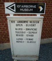
The 101st Airborne Museum in Bastogne

The 101st Airborne Museum in Bastogne

The 101st Airborne Museum Bastogne

The 101st Airborne Museum is located in the town center, close to the central bus station. It is located in a historical building, the former officers’ mess of the Belgian army, which was later used as a German “Unteroffiziersheim” during the occupation of Bastogne. After the war, it served as a Red Cross hospital. The building was carefully restored and is a perfect location for a museum (as is the Villa Hartenstein in Arnhem-Oosterbek). The museum is quite new, modern and nicely styled.

What distinguishes this museum from the many other Bulge museums we visited during our tours, is the fact that there are no common shop window mannequins used for the dioramas – but lifelike, very realistic figures with highly detailed faces and expressions, reminding us of wax figures in Madame Tussaud’s. Every soldier and person depicted has an individual, expressive face and conveys strong emotions. So all dioramas appear to be realistic and naturalistic.

Together with these excellent mannequins, decent faint and classic music from hidden speakers conveys an almost pious atmosphere, in contrast to many other loud, crowded and colorful War museums. Especially remarkable are the “re-enactments” of famous photographs with life-size figures.

Read the rest of this entry »

Posted in HFC On Tour, Historical Sites, Museums, Visiting Battlefields | Tagged: , , , , , , , , , , , , | 7 Comments »

HFC on Tour: Ancient Rome in Germania inferior, Part I: Matrones’ temples

Posted by Denny Koch on November 12, 2012

Nettersheim / Görresburg

One of the main advantages of living in the Eifel region of Rhineland-Palatinate is – besides the spectacular landscape and the fascinating geology – the fact that, wherever you go, the Romans have been there before!

And the Romans left their marks, often in astonishingly good shape and condition. As inhabitants of Germania inferior (the region left of the river Rhine), it takes us only a short drive to visit ancient sites of great historical importance. In our town, there is the famous “Römervilla” (Roman villa), the largest Roman mansion North of the Alps. If we cross the Rhine, we can walk along the Limes, often with reconstructed garrisons and watchtowers.

At the lower Rhine, there is the city of  Xanten, Roman: Colonia Ulpia Traiana, with Germany’s biggest archeological open-air museum. At the Mosel river, you can find Germany’s oldest city Trier (Augusta Treverorum) with the famous Porta Nigra and another archaeological park.

Pesch

Last but not least, Roman temples, mines, quarries, houses, aqueducts are scattered all over the region, often only hinted at by a small sign at the side of the road. Since we visited many of these Ancient Roman sites in Germania, we want to share our experiences with you history buffs 🙂

The first travel report is about a very special tour through the Eifel – and an insider’s tip: you can find three very important Ancient Roman temples here where Matrones, female deities, were venerated. One of the world’s most famous and best-known consecration stones, showing the Aufanian Matronae, was discovered here.

If you want to visit the temples in Zingsheim and Nöthen-Pesch, you best go there by car. The area is very rural and there is no chance to get there by public transport. The largest temple in Nettersheim can be reached by train, though. It’s a medium length walk from the railway station at Nettersheim to the temple site, located on a small hill.

If you are the athletic type, you could go to Nettersheim by train and then visit the other temples by bicycle or even hike to the other temples from there, but a car is strongly recommended for the casual historical interested tourist! The next larger town is Bad Münstereifel, the “unofficial capital” of the Eifel region, which also has a railway station.

Read the rest of this entry »

Posted in HFC On Tour, Historical Sites | Tagged: , , , , , , , , , , , , , | Leave a Comment »

HFC on Tour: Spiel 2012 in Essen, the world’s biggest consumer fair for gaming

Posted by Denny Koch on October 23, 2012

Gaming tables everywhere!

This year, we attended SPIEL 2012 in Essen, the world’s biggest consumer trade fair for gaming. The fair was held in the Messe Essen from Oct 18th – 21st, which means four days of playing and testing popular and new (even unpublished) games and, of course, the opportunity to buy games. This attracted about 150,000 visitors from all over the world.

On 46,000 square meters of exhibition space, you can find all kinds of games and gaming equipment – from Eurogames to classics (like Chess and Go), consims and wargames, board games, card games, electronic games, role-playing games, tabletop games, up to LARP equipment such as armor, weapons, costumes, and clothing. In addition there is “Comic Action“, a Comic fair, which is part of Spiel. Here you have the opportunity to see, read and buy all kinds of comics and comic related stuff, from European and US mainstream comics up to quite bizarre Japanese Manga products.

Home of Wargamers!

Spiel 2012 was a really big event (the exhibition area, which extends over 10 halls, is even larger than Gamescom, the annual European video games fair in Cologne) and attracted visitors and exhibitors from all over the world. You could find the big players (for example Hasbro, German company Ravensburger…) next to small and highly specialized game shops, independent publishers, smaller companies and publishers (GMT Games, Matrix Games / Slitherine, UGG, Twilight Creations, Days of Wonder, Eagle Games…), organizations and clubs (the German consim society GHS, The Guild of Role Playing Gamers), and special booths, giving an overview over games from a certain country, for example Russia, or South Korea. Even companies who specialize in proofreading game concepts and producing your components (counters, maps etc.) were represented. There were also gaming championships and open tournaments going on, as well as workshops and tutorials.

Entire sections were dedicated to gaming equipment, for example dice, tabletop painting and modelling equipment, or card sleeves, and clothing and weapons for knights, orcs, and the medieval LARP household.

The Location

The Galeria

Essen is one of the 10 largest cities in Germany and located in the heart of the industrial Ruhr area. The infrastructure is very good, the city can be reached easily by plane (via airport Düsseldorf), train, or car. It takes only a few minutes from the central station to the fair grounds “Messe Essen” and shuttle busses as well as subways connect the Messe to the inner-city.

We went to Essen by car, which took probably longer than getting to the fair grounds by subway, because the sheer size of the fair led to a minor traffic collapse around the Messe. There were several parking lots, but some were reserved for exhibitors or journalists, and most of the public parking lots in the Messe vicinity were already occupied by the time we got there. A parking guide sent us to a remote parking lot and advised us to return with the (free of charge) shuttle bus, but fortunately, we discovered a secret parking garage near the Gruga park, a large city park close to the Messe.

Read the rest of this entry »

Posted in Events and Conventions, HFC On Tour, Wargaming in general | Tagged: , , , , , , , , | 1 Comment »

HFC on Tour: Luxembourg City and General Patton’s grave

Posted by Denny Koch on October 19, 2012

The casemates of Luxembourg city are the world’s biggest casemates

On our tour through the Ardennes this summer, we became fans of the Grand Duchy of Luxembourg – a small, friendly, and very relaxed country in the heart of Western Europe. We didn’t have enough time to visit the capital Luxembourg City then, so we decided to make another trip into our neighboring country and visit the capital as well as the US and German war cemeteries in the city vicinity.

We went to Luxembourg city by car, using the opportunity to fill up our car (Luxembourg has very cheap gas prices, compared to the incredibly expensive prices in Germany, Belgium, and the Netherlands).

Despite being a medieval city, located on several sandstone plateaus and cliffs above steep valleys, your first impression when you enter the city is the skyline of the banking district  dominated by skyscrapers of several banks, funds, and the European Parliament. These are in a stark contrast to the Frankish castle, the Gothic Cathedral and massive forts that dominate the old town.

Topography and Language

The old town, as seen from the Bock Casemates

The topography of Luxembourg city is quite dramatic – most of the city is located on various sandstone cliffs which are separated by two deep-cutting rivers – the Alzette and Pétrusse – with pittoresque parks and recreational areas 70 m (230 ft) below the plateaus. The city districts are connected by large bridges and viaducts, one of them the world’s 2nd largest arch bridge (the largest being in China), the Adolphe Bridge. This bridge is one of the main tourist attractions and a kind of  unofficial national symbol, symbolizing Luxembourg’s independence.

The city has about 100,000 inhabitants and is the largest city in the country of Luxembourg.

The official languages are Luxembourgish, French, and German, but French appears to be the most popular language by far, followed by the curious Luxembourgish which is a close relative to the Mosel-Frankish German dialect. Both are hard to understand for Germans from other regions. Strangely enough, many shops (even McDonald’s or Saturn, one of the largest electronics shops) have German product displays and ads, but the staff only speaks French and if you switch to German, they answer you in English… You soon get accustomed to the Babylonian language mingle-mangle in this country, so if one language doesn’t work, you simply switch to the next language, and the answer will probably be in a third language or with hands and feet. The inhabitants even tend to mix French and Luxembourgish within one sentence, using both languages in their conversations simultaneously. English also isn’t a problem at all since Luxembourg City is a very international and very European city.

One of the famous viaducts

Since the city is located on several plateaus, connected by bridges, understanding the geography isn’t an easy feat. We tried to follow the parking guidance system into the city and ended in a parking garage near the “gare” (meaning railway station). We were under the impression that a railway station must be located close to the city center, but learned later that the station was intentionally built outside the city center (about 2 km, on a different plateau) for defensive reasons.

We walked through the area around the station which is a modern shopping district, dominated by the usual combination of McDonald’s / Subway / fashion stores of a typical European major city.

Then we reached the Adolphe Bridge and were impressed by the height and the dramatic landscape all around us. We later asked a tour guide how often people jump from this bridge in order to commit suicide, and learned that there was an ever higher bridge which was the favorite suicide location until they built a high fence instead of a handrail.

Deep below Adolphe Bridge is a river with a nice park, which is used by tourists and Luxembourgers alike when they want to skate, bike, relax, meet, or read.

Read the rest of this entry »

Posted in HFC On Tour, Historical Sites | Tagged: , , , , , , | 5 Comments »

HFC On Tour: Battle of the Bulge – the Ardennes

Posted by Denny Koch on September 5, 2012

Clervaux is the perfect base for an Ardennes tour – every other interesting location is in a 30 km-radius!

This summer, we decided to tour the Ardennes in Luxembourg and Eastern Belgium. In villages and small towns like Wiltz, Diekirch, Ettelbruck, or St. Vith you can find (official and private) Battle of the Bulge museums and memorials next to medieval castles, monasteries and old churches. The scenery is impressive as well, you find deep valleys, cut by small rivers, surrounded by steep rock formations and dense forests. If you happen to visit the Western Ardennes around Bastogne, you should also consider taking a trip to the Eastern battlefields – here is why 🙂

Clervaux

Don’t miss our extensive photo gallery with many more pictures from our tour!

Clervaux castle contains a Battle of the Bulge museum

Our hotel was located in the medieval town of Clervaux (Luxembourg Ardennes), which is a perfect central basis for exploring the surrounding locations.

The small town (app. 1000 inhabitants) is dominated by a massive castle from the 12th century, which also contains a Battle of the Bulge Museum. Clervaux is also famous for a Benedictine monastery on top of a hill above the town. The village is located at the small river Our, lies deep in a rocky valley, and is almost completely surrounded by tree-covered, steep hills.

If you don’t travel by car, Clervaux has a small railway station and you can reach it by train from Luxembourg City or Liege / Belgium. Parking your car isn’t an issue here (in contrast to the difficult and very expensive parking situation in Arnhem!), you can park your car almost everywhere by simply ignoring the no-parking signs because they are of no consequences (a recommendation from our hotel owner, and it proved to be true, we never had any parking problems in any towns in Luxembourg).

Clervaux Memorial for the 6th US Armored Division

From December 16th to 18th, 1944, Clervaux was the scene of heavy fightings during the Battle of Clervaux (which has been referred to as the “Luxembourg Alamo“). American forces from the 110th Regiment and 109th Field Artillery Battalion were encircled by overwhelming German forces from the 5th Panzer Army and 126th Infantry Division, and retreated into the Clervaux castle. In the end, the US forces were forced to surrender when German tanks broke into the already burning castle, but at least they had managed to delay and bind large German forces for two days, thus slowing the German timetable of the time-critical offensive. Clervaux castle was heavily damaged during the battle, and the restoration was not finished until 1994.

In front of the castle are a German 88 artillery and an US Sherman tank which participated in the Battle of Clervaux. There is also a memorial next to the central square of Clervaux, commemorating the liberation of Luxembourg in 1944.

Other interesting sights in Clervaux are the Saint-Maurice and Saint Maur Benedictine Abbey, where you can listen to the Gregorian chants of the monks inside the church several times a day, and the impressive catholic church Saints Cosmas and Damian. In the Abby catacombs is an ongoing exhibition about life at a Benedictine monastery. There is also a golf course in the vicinity (which is rumored to be quite good) and most of the hotels also offer wellness and Ayurveda.

Clervaux War Memorial

Beware, there is no pulsing nightlife in the quite little town of Clervaux (in contrast to lively Arnhem)! There is a nice restaurant with beer garden in the woods above the city, “Ecuries du Parc“, which is located in the rustic building of the former horse stables of the Earl of Clervaux. Prices for meals are, as everywhere in Luxembourg, quite expensive (compared to prices in Germany), but the restaurant is excellent, as is the beer, and the historical, rustic atmosphere is very enjoyable. Everything in Clervaux is reachable by foot, so there is no need to drive by car from your hotel and you can enjoy the various beers offered here.

Another recommendation for spending your evenings is the Bistro 1895 in our hotel, the Hotel des Nations. It offers good meals, diverse local beers and other drinks, so we drank ourselves through the various Luxembourgian and Belgium beers here. The atmosphere is relaxed and familiar – the hotel and the bistro are family owned since 1895, and the couple who own the hotel will happily tell you about the history of the hotel, their ancestors (who are displayed on family photos on the walls and even on the menu card), and about the good old times in Clervaux.

Read the rest of this entry »

Posted in HFC On Tour, Historical Sites, Museums, Visiting Battlefields | Tagged: , , , , , , , , , , , , , , , | Leave a Comment »

Visiting Battlefields: The Huertgen Forest and the Siegfried Line

Posted by Denny Koch on November 7, 2011

Above the Kall Trail in the Huertgen Forest

Vossenack, Kommerscheidt, Hürtgen, Schmidt – the names of these German villages are better known in the US than in Germany. If you tell your co-workers in Germany that you will spend your next weekend in the Huertgen Forst, they will give you a weird look and ask you: “Where? Where is that?”

The reason why this region and the Battle of Huertgen Forst are almost unknown to the average German citizen is the fact that this battle “didn’t take place”. Actually, when the Americans got over the Siegfried Line and crossed the German border, Hitler was deep into his preparations for the Ardennes offensive. The fact that Allied soldiers had entered the German homeland was a disaster for German propaganda – which was anxious to make the public believe that the Allies were held up in the West, in France and Belgium. So this battle was swept under the carpet and the German public was told that the Allies were stalled somewhere in the West. The locals of the Huertgen Forest were evacuated, so there were no eyewitnesses to the events in the region, and it was prohibited to talk about what happened there.

The Battle is still very present in the forest. Here: US armor tracks, melted into the ground

The Battle in the Huertgen Forest was one of the bloodiest battles in World War II, it was the longest single battle ever fought by US forces and the trench warfare character of this Battle made it known as “the Verdun of WWII”. Veterans of Huertgen Forest stated that this battle was bloodier than the landings at Omaha Beach. Nevertheless, even today many Germans never heard about the Battle of the Huertgen Forest or could locate this region on a map.

The Huertgen Forest (German: Hürtgenwald) is located in the far West of Germany, close to the Belgian border, in the National Park Eifel close to the Belgian National Park  Hohes Venn, South of the cities of Aachen and Düren and north of Monschau.

Fortunately, the Hürtgenwald region is very active in commemorating history. Even today, people in Vossenack or Schmidt are still living with the after-effects of the battle: Some areas are still mined because there are almost no maps left showing the position of the minefields. In addition, there were also glass and wood mines used which cannot be detected by metal detectors. You are advised not to leave the signposted routes in the forest, and if you want to build a house, first thing you do is call an explosive disposal team to check the ground. Each year, the remains of about 7 soldiers are discovered in the forests and fields.

The Battle is still present everywhere in the region. In Vossenack is the Hürtgenwald 1944 museum which is maintained by the private “Historical Society Hürtgenwald in 1944 and in peace”. There are many memorials all over the place, for US soldiers as well as for Germans. One memorial is quite special: it is a memorial for a German officer donated by US soldiers.

Following the Kall Trail down into the steep Kall valley

You can follow the infamous (well sign-posted) “Kall Trail” down into the forest where many remains of the Battle are still visible today. There are two large German war cemeteries in Vossenack and Hürtgen (US soldiers were buried in cemeteries outside Germany, for example in Belgium and the Netherlands, or transferred back home).

The German veteran organization “Windhunde” (former members of the 116th Panzer Division (“Windhunde”) and their families, friends and descendants) is still very active in commemorating the Battle. They set up a large memorial next to the Vossenack cemetery, and they cooperate closely with US veterans. Each year in October there is a Remembrance Walk through the forest by US and German veterans, visitors, and citizens together with many events like an American style BBQ, meetings, and lectures.

We went to the Huertgen Forest in September, on a very sunny day, but when you walk deep down into the forest, you learn very soon that you wouldn’t want to spend an entire winter there. The forests are very steep, the ground consists of solid rocks, and the conifers forest is dense and dark.

As guide books, we used the “Militärgeschichtlicher Reiseführer” by Peter Többicke and the very good “Hürtgenwald 1944/1945 Militärgeschichtlicher Tourenplaner” by Rainer Monnartz. The last book is especially good and highly recommended if you can read German because it offers complete tours with location descriptions, photos, and even GPS coordinates, which proved to be very helpful.

Read the rest of this entry »

Posted in HFC On Tour, Historical Sites, Museums, Visiting Battlefields | Tagged: , , , , , , , , , | 54 Comments »

Visiting battlefields: The Bridge of Arnhem – Operation Market Garden

Posted by Denny Koch on October 19, 2011

John Frost Bridge as seen from the Airborne Memorial

This summer, we decided to visit the battlefield of the largest airborne operation in Europe during World War II: The Arnhem region in The Netherlands, scenery of “Operation Market Garden” in September 1944. As a guide-book, we used “A Tour of the Arnhem Battlefields” by John Waddy.

Arnhem then…

The main idea behind Market Garden was the seizing of the most important bridges across the rivers Rhine and Maas which would allow the advancing Allied ground forces to flank the Siegfried Line and to march straight towards the important industrial areas in Germany.

Original bridge pillar

British, Canadian, Polish, and US paratroopers got the objective of capturing bridges between the Dutch cities of Eindhoven, Nijmegen, and Arnhem. The first bridges could be seized successfully, but the bridge in Arnhem was “one bridge too far”, so that the Allied forces suffered a disastrous defeat and had to retreat under heavy losses – which prolonged the war and led to the “Hungerwinter” of 1944 where 18.000 Dutch civilians starved to death due to the fact that the Germans cut off the supply to the Netherlands as a retribution for the Dutch support and aid of the Allied landings.

What went wrong in Arnhem? Well, the most important mistake was to underestimate the German presence in the area. Allied intelligence suspected that the German forces were scattered, poorly equipped, and that some of the spotted tanks were dummies or decoys. As a matter of fact, the German forces around Arnhem were the II SS Panzer Corps, consisting of the 9th and 10th SS Panzer divisions who were drawn back behind safe frontlines to be resupplied and refitted. So the Allied forces met some of the few remaining German elite forces at Arnhem, restored to full strength and equipped with all kinds of heavy equipment.

The British paratroopers of the 1st Parachute brigade became trapped at the Bridge of Arnhem and surrounded by heavy German troops. The trapped soldiers were shelled by mortars, artillery, and tanks, while most of the attempts to relieve or even evacuate the men were in vain. Lt. Colonel John Frost and his troops defended the Bridge to the last bullet for several days, until they ran out of ammunition.

…and today

You can follow the "Liberation Route" through Arnhem

In and around Arnhem, Operation Market Garden is still very present. You can find memorials all over the area, even in private front yards, and all memorials are well-kept and decorated with fresh flowers or small wooden crosses with personal notes like “we will always remember”. Each year in September, the “Airborne Wandeltocht” (“Airborne March”) takes place which is the world’s largest 1-day marching event. The march is attended by civilians, visitors from all over the world, military, veterans, and police. The route is along the drop zones and battlefields of Market Garden in the area around Arnhem and Oosterbeek.

There are two important museums, and you can even follow the “Liberation Route” around Arnhem which leads you to the most important sites which are extensively described on information boards in English, Dutch, and German. The boards also show photos from the era and of the respective location during the war. In addition, there is the “Perimeter route” around Oosterbeek which is also well signposted.

The area around Arnhem is so rich with history that you should bring enough time. One or two days certainly aren’t enough if you want to visit all important sites and memorials. We spent three days in Arnhem and we will certainly return there one day to see more of this very interesting and fascinating region with their friendly and open-minded people.

Read the rest of this entry »

Posted in HFC On Tour, Historical Sites, Museums, Visiting Battlefields | Tagged: , , , , , , , , , , , , | 21 Comments »

Ordensburg Vogelsang – a field trip

Posted by Denny Koch on April 17, 2011

The eagles of the "Adlerplatz", Ordensburg Vogelsang

One sunny weekend in April, we decided to make a field trip to the NS Ordensburg (“Order Castle”) Vogelsang, located in the western Eifel region of Germany, close to the Ardennes, Huertgen Forest and the Belgian border.

Castle Vogelsang was built by the National Socialists in 1936 in order to serve as an elite educational center for future leaders. It is the second largest relic of National Socialist architecture after the Reichsparteitag in Nürnberg. After World War II, the castle served as Belgium barracks and NATO training area. It was handed back to Germany for civil use in 2006. Since then, it is open to the public and still under transformation into a documentary center.

Location

An old photograph of Burg Vogelsang

Ordensburg Vogelsang is located near the small town of Gmünd in the district of Schleiden, high above the Urft dam in the National Park Eifel. The area of the landmarked buildings is 50,000 square metres, but only 20% of what was planned was eventually finished before the outbreak of World War II, which marked the end of the educational program.

Some minor parts of the castle were destroyed in WWII, but large parts of the castle survived the bombardments (which were mainly directed against the nearby Urft and Schwammenauel dams). The Ordensburg was hastily erected within two years by 1,500 workers. It looks ancient and rustic because the buildings appears to be made of quarry stones from the region, but in fact the buildings were made of concrete and steel frames which were  only hidden under the seemingly massive stones.

The place for the roll-call

Since the educational center was meant to resemble an Order Castle of the Deutscher Orden (Order of the Teutonic Knights), it needed a high tower which actually was a water tower (it never worked as planned, so it wasn’t used). In addition, there are several other buildings, for example community houses, a Thing place, a stadium, a gym, swimming pool, comradeship houses, a place for roll call etc..

Monuments showing the “ideal human” (who was meant to be educated here) can be found all over the place.

The main building next to the tower was destroyed in WWII and rebuilt in the original style later. Today, it contains the National Park Eifel tourist information, an educational center, a museum shop, and a small exhibition.

There is no entrance fee to visit the Ordensburg, but it is highly recommended that you participate in a guided tour which costs moderate 5 Euros. The tour guides are highly motivated honorary volunteers who lead you around the area in small groups of 15 people. A guided tour takes between 90 minutes and 2 hours. You can also climb up the tower which is 48 meters (157 feet) high, which costs 3 Euro and is also accompanied by a guide.

If you want to explore the area on your own, you can follow one of the three round tours which are very well signposted with information boards in German, English, Dutch, and French.

The distant ghost town Wollseifen

Close to the Ordensburg is the ghost town of Wollseifen. After WWII, the British forced the population to leave the town because they wanted to use it as a training area for city fights. Over the years, the original city was destroyed and fake buildings were erected. The training ground was later used by NATO forces, preparing for missions in former Yugoslavia, and by the Red Cross and other organizations.

Today, you can visit the deserted fake town (you have to walk there by foot and you are not allowed to leave the marked path when you go there), but it is planned to tear most of the buildings down and leave only the church (which is still the original one, minus the roof which was destroyed and replaced), which should then contain a documentary center about the buildings and life in the old village Wollseifen.

History

Junkers at the roll-call place

In 1933, Adolf Hitler declared that he planned to erect educational camps in order to educate new leaders. He was in desperate need of loyal people with leading qualities who should replace the old cadres who often had a different political opinion. Hastily, three educational camps were built: Ordensburg Vogelsang in the Eifel region, Crössinsee in Pomerania, and Sonthofen in the Allgäu Alps. These locations were chosen with care because they are all located within impressive and beautiful German landscapes – which should help to convince the leadership candidates of the beauty of their German homeland – and the need to expanse it.

Vogelsang was built on a hill above the very popular Urft reservoir which was a local recreation area with hotels and boats. It was also planned to build a gigantic “Kraft durch Freude (KdF) hotel” (“Strength through joy”) by the state-controlled leisure organization of the German Labour Front. The hotel was never built, though. Vogelsang was financed by the confiscated capital of the abolished labor unions and employer’s organizations.

The educational centers were soon dubbed “NS-Ordensburgen” (Order Castles) to emphasize the historical connection with the Teutonic Knights and their crusades into Eastern Europe. Vogelsang was planned by the Cologne architect Clemens Klotz who had also built the colossal KdF building in Prora on the island of Rügen, which is a 4,5 km (=2,8 miles) long concrete building along the coast line.

The panorama view from the tower is magnificent

Within two years, the main parts of Vogelsang were finished and education could begin. More buildings, for example a gigantic “House of Knowledge” or a sports stadium which was even larger than the Olympia Stadium in Berlin were planned, but never finished. Construction was halted with the outbreak of WWII.

View from the tower

In April 1936, Vogelsang was officially handed over to Adolf Hitler. The first 500 hand-picked “Junkers” moved into Vogelsang. They were personally chosen by Reichsorganisationsleiter of the NSDAP, Robert Ley.

The term “Junker” was also derived from old German feudal traditions, where they described members of the nobility. Junkers were not chosen upon their background, family, education, or job. On the contrary, the backgrounds of each candidate were never a subject to discussion and certificates were ignored. Other qualities were of greater importance: arian appearance, perfect physical health, proof of arian descent, proof of military service, engagement for the community, and they had to be married. Most were in their mid-twenties and some were even overtaxed by the intellectual indoctrination program, so the major focus in Vogelsang was shifted to sports and physical activities. Education mainly composed of the topics race science and geopolitics as well as good manners.

Adlerplatz without Adler (=eagles)

Because of the harsh regiment and drill, many Junkers quit and searched for easier ways to make money and a career. Payment also wasn’t very high; while their families were adequately supplied, they only got a few Reichsmark per day, just enough to buy a beer at the local tavern. 80% of the graduates later died in the war at the various fronts because they fanatically volunteered for the Wehrmacht, despite the fact that they were offered higher positions in the government. Some, of course, became administrators of occupied regions where they often were strongly involved into war crimes.

Despite the fact that the Junkers were supposed to become “the elite” who should later occupy key positions within the Reich, their accommodations were far from being luxurious. On the contrary, they lived and slept in so-called “Hundertschafthäusern” (“houses of the one hundred”) where they slept in large dormitories with about 50 men, side to side. The only other furniture besides rows of beds were lockers.

The day began early at 6.00 AM with morning exercises. 7.00 AM mustering at the roll-call place, followed by lectures, classes, and group work. After lunch, afternoon sports exercises. 5 PM-6.30 PM: more lectures and group work. 10 PM: rest.

The Thing place where ceremonies and festivities were held

Because of the isolated location deep in the Eifel region, the Junkers didn’t have much opportunity to spend their spare leisure time outside the castle walls. Instead, they were sent to various events, celebrations, and Nazi stagings all over Germany as “audience” in order to provide for a large, cheering crowd. The Ordensburg maintained a large motor pool just for moving Junkers around from one event to the next, even to the Reichsparteitag (Nürnberg Rallys) to ensure that there were always loyal, cheering masses in the public who would inspire other visitors and common people.

With the beginning of WWII, the junker program was halted and the castle was handed over to the Wehrmacht which used it as a staging area for large-scale operations, for example the Ardennes offensive in 1944 and the Western campaign in 1940, and as a field hospital.

At the end of WWII, the castle fell into British hands, who soon handed it over to the Belgium military authorities. The Belgians erected the Van Dooren barracks (named after the first Belgium casuality in WWII), and the castle was used as a training ground for NATO troops. NS symbols like swastikas were removed and many monuments were damaged (mainly by using them for target practice), but the buildings remained unharmed. The new barracks were even built-in the original architectural style. Some monuments remained intact, especially a large relief in the swimming bath, and some “torch bearers”.

In 2006, the castle was handed over to the German Government and was opened for the public. Today, a non-profit association is tasked with researching and documenting the history of the castle as well as making new plans for the future. A youth hostel is currently under construction, as well as a “Center for the Youth & Europe” where young people from all over Europe come together for common projects about nature and NS history.

Visiting Vogelsang

All information is available in German, English, Dutch, and French

We went to Vogelsang by car (you can also reach it with public transport, but the castle is located deep in the Eifel, so getting there is somewhat adventurous). If you take a route trough the Eifel hills and forests and small villages, you will get a good impression of the difficult terrain the Allied forces faced in the Ardennes and Huertgen forest.

Vogelsang has a large parking lot. From there, you have a good view across a valley to the ghost town of Wollseifen. From the parking lot, you have to walk about 500 meters (0.3 miles) to the main castle with the tourist information, some restaurants, museum shop, and exhibition.

Guided tours take place daily at 2 pm and you have to buy your ticket at the information. You are then assigned to one of the several tour guides. Vogelsang is highly frequented by tourists from all over Germany, the Netherlands, Luxemburg, Belgium, or France. The castle is visited by about 200,000 visitors per year, most of them on spring and summer weekends.

We arrived at 1 pm, so we had one hour left until the guided tour. We went to the roll-call place and enjoyed the magnificent view over the Eifel hills, the Urft reservoir and dam and visited a small exhibition about “Organized vacations in the Third Reich”. The exhibition was interesting, it showcased many original KdF posters and explained the Third Reich philosophy of sending workers and people of all classes on recreational trips, sponsored by the Labor Movement and full of “community-building” activities (in other words: propaganda).

High above the Urft reservoir

Besides information about Ordensburg Vogelsang, the tourist forum also informs about the Nationalpark Eifel which is an important wildlife sanctuary and also interesting because of the geological past (the Eifel is a vulcanic region) and historical locations (military locations like the Westwall, but also ancient Roman and Medieval sites).

At 2 PM, we met with our tour guide. With a group of 15 people, we were then led through the vast castle area. The tour was very interesting, the tour guide was a local who lives in a nearby village. His mother had been a child when Vogelsang was still a Ordensburg and he remembered interesting stories about how the local children had to line up along the road to the castle when Hitler came for a visit.

He also took some large images with him where he showed us how a certain place, monument or building had looked when the castle was still in use. Amazingly, today most of the buildings still look like they did then. Only some of the monuments are severely damaged, for example the sportsmen monument. It was interesting to see how it had originally looked like before the Belgians used it for target practice, especially by shooting at the faces and genitals of the statues.

Taking a guided tour is a must

The guide allowed us to enter one of the houses where the Junkers slept in groups of 50. The beds and lockers had been removed, of course, because the buildings were used by the Belgians and others over the last 60 years. You could still see how hastily the castle was erected and it was quite disillusioning to see the concrete walls within the seemingly ancient and massive “quarry stone” buildings.

You are not allowed to enter the other buildings (besides the main building) on your own and they are usually locked, so if you want to see one from the inside, you have to participate in a guided tour.

Our guide then explained the Thingplatz to us where festivities were held on Summer Solstice or Hitler’s birthday. This place was built along the slope from the castle down to the Urft reservoir in a somewhat amphitheater-like style. Participants sat on over-sized stairs while fires were lit all along the slope and on giant statues like the torch-bearer (which must have been a quite impressive sight, but Nazis were famous for staging impressive events).

We learned a lot about life and education in Vogelsang and the guide was very engaged and open to questions without moralizing or displaying the common “I would not have joined in, I would have been in the resistance since day 1” attitude you often meet in German historical sites dealing with National Socialism. On the contrary, he compared Nazi Germany and the propaganda and brainwashing machine to today’s North Korea and pointed out the similarities between the marching masses in both countries. Since you were manipulated 24 hours a day while being offered work, a simple solution for all your problems, and adventure, fun and comradeship in the Nazi youth organizations, he didn’t reject the possibility that he would have been attracted to the Hitler youth as a teenager or to becoming a Junker where you were constantly told that you were the elite and the best of the best, meant to rule the Reich. This was a very interesting and quite uncommon point of view, and we were really surprised about his open words.

In the end, the tour took almost 2 hours.

A "Hundertschafthaus" from the outside...

Inside the Hundertschaftshaus where 50 Junker slept

The tower as seen from the Thing place

The Thing place

Over-sized stairs

The tower

After the tour we decided to climb the tower. You are not allowed to climb the tower on your own, the spiral staircase is very tight and you need to be free from vertigo or claustrophobia if you want to climb up the 172 stairs. Only 15 people are allowed in the tower at a time, but we were only 3, so we had another guide (this time a trainee girl) almost for our own.

The view from the tower was great, you could see all over the Urft reservoir and dam, over the castle area, and up to several Eifel towns with their wind power turbines, and last but not least, the ghost town of Wollseifen. The guide showed us the most remarkable landmarks and explained them to us, and afterwards we could enjoy the view for a few more minutes. Climbing the tower and enjoying the view took about half an hour. There are many castle buildings spread all over the hill, and it’s hard to imagine that they only comprise about 20% of what was originally planned. If the Nazis had had enough time to finish their plans, the size of the entire complex would have been beyond imagination.

The "Fackelträger" (torch-bearer)

We also visited the “Fackelträger” (Torch bearer) monument, which in fact was a giant torch. During ceremonies, the basin on top of the monument was filled with oil and then ignited, so that the entire statue was lit by a giant flame which could be seen even at the Urft dam.

The swimming bath is open to the public and used by the locals from the nearby villages. Amazingly, the relief of three “ideal” humans is still intact and can be seen through a small window, if you don’t want to swim. We went across the Thingplatz, visited the damaged sportsmen, and finally moved back to the Adler place. This huge place was named after the two eagle statues which had been there, but today, the damaged eagles are removed from their podiums and placed next to a wall.

The weather was great, sunny without a single cloud with a fresh wind and modest 20 C (68F) and since it was early April, the location wasn’t too crowded with tourists either. If you are in the Eifel or Ardennes region or visiting Belgium or the Netherlands, you should visit this interesting location – it is well worth a visit!

The size of the Fackelträger compared to a human...

The swimming bath relief is still intact

...while the sportsmen relief was used for target practice

The original sportsmen

If you are interested, visit the official Ordensburg website at: www.vogelsang-ip.de. Information is available in German, English, Dutch, and French. You can get there by car or by train (there is a National Park bus shuttle service from Kall railway station, only on weekends). As mentioned above, there is no entrance fee. The area is open from 8 AM – 8 PM, the forum and restaurants are open from 10 AM – 5 PM.

Visit our image gallery for more photos!

Posted in HFC On Tour, Historical Sites | Tagged: , , , , , , | Leave a Comment »

Speyer – visiting the 2000 year old Imperial City

Posted by Denny Koch on September 25, 2010

The famous Imperial Cathedral

In July 2010, we visited one of the oldest cities in Germany: Speyer, the 2000 years old Imperial city of Roman origin, next to the river Rhine. It is located in the Palatinate region, surrounded by the low mountain ranges of the Palatinate forest and the Odenwald.

Historical overview

Speyer is a very interesting city with a rich history. Before the arrival of the Romans, it was a very lively German settlement, located on one of the most important ancient traffic routes because of its close proximity to the Rhine and the river Neckar (which eventually leads into the Danube). The oldest archeological finds are from the Neolithic, the Bronze Age, and Hallstatt culture. Certainly the most famous and most important archeological discovery was the Golden Hat of Schifferstadt, dating back to 1,500 B.C. This hat can be admired in the Historical Museum of the Palatinate in Speyer – which we did.

Speyer has a rich Roman history, as you will learn in the Historical Museum of the Palatinate

Pre-Roman Speyer was settled by the Teutonic tribe of the Nemetes and by Celts. Around 10 BC, the Romans (who had just conquered the Gauls) erected a military garrison which was intended to protect the Rhine and  to serve as a base for further conquests on the east side of the Rhine during the reorganization after the disaster in the Teutoburg Forest. After a while, the settlement began to flourish and became the Roman city of Civitas Nemetum.

The Historical Museum of the Palatinate has a very large and impressing exhibition of Roman, German, and Celtic finds from the region and we really enjoyed our visit in the Museum. Actually, it is one of the most enjoyable historical museums we ever visited and the exhibition items are well-arranged and presented in a very modern and lively fashion.

In 346 AD, Speyer became a diocesan town and in the 969, Emperor Otto the Great granted the bishops immunity and special privileges, so that Speyer actually was controlled and ruled by the bishops. With the election of the Salian king Konrad II who became King of Germany, Speyer became the Imperial city from which the Emperors ruled over the country for centuries.

The Romanic cathedral was added to the UNESCO world heritage list in 1981

In 1061, one of the most famous Romanic cathedrals in Germany, the Speyer Cathedral, was consecrated. Today, the cathedral is a UNESCO World Heritage site and certainly worth a visit. In the crypt, the tombs of the old German emperors can still be visited today.

The "Altpörtel" is one of the oldest and most important city gates in Germany

During the Middle Ages and under the rule of several Emperors, many important historical events took place in Speyer: Henry IV departed for Canossa in 1071 and Bernard of Clervaux went here at the beginning of the Second Crusade in 1141. In 1143, Richard the Lionheart was extradited to Henry VI.

Later, Speyer suffered heavy destruction during several wars (the Thirty Years War, War of the Palatine Succession), when the city was occupied by Spanish, Swedish, French, and Imperial troops. At the end of the 17th century, Speyer was put to the torch, so that over 700 houses were destroyed.

Under Napoleon, Speyer fell to France but was returned to Germany later. Under the Nazi regime, the famous Speyer synagogue was destroyed in the Reichskristallnacht which marked an end to the rich Jewish life for which Speyer was famous since the 11th century. During World War II, fortunately the city wasn’t destroyed, only 2 allied bombs hit the town and the Rhine bridge was destroyed by retreating German forces. The city was then liberated by US troops and became part of the French occupation zone later.

In 1990, Speyer celebrated the 2000-years-anniversary. With the Cathedral, the fantastic museums (Historical Museum and the Technology Museum which is one of the largest in Europe and famous for the Russian Space Shuttle Buran), many buildings from the Middle Ages, one of the largest Medieval city gates (called “the Altpörtel”), lots of Biergartens, and amazingly friendly and open-hearted locals, Speyer is certainly worth a visit and a tourist attraction you shouldn’t miss if you happen to come to Germany.

HFC on tour: travelogue

Check out our image gallery for many more photos!

We arrived in Speyer by train on one of the hottest days this summer (close to 40 C / 104 F). You should know that Germany is famous for NOT having air condition in buildings, especially not in old historical towns (except from big stores and supermarkets…), so places for cooling down were rare.

Read the rest of this entry »

Posted in HFC On Tour, Historical Sites, Museums | Tagged: , , , , , , , , , , , , | Leave a Comment »