Visiting Battlefields: The Huertgen Forest and the Siegfried Line
Posted by Denny Koch on November 7, 2011
Vossenack, Kommerscheidt, Hürtgen, Schmidt – the names of these German villages are better known in the US than in Germany. If you tell your co-workers in Germany that you will spend your next weekend in the Huertgen Forst, they will give you a weird look and ask you: “Where? Where is that?”
The reason why this region and the Battle of Huertgen Forst are almost unknown to the average German citizen is the fact that this battle “didn’t take place”. Actually, when the Americans got over the Siegfried Line and crossed the German border, Hitler was deep into his preparations for the Ardennes offensive. The fact that Allied soldiers had entered the German homeland was a disaster for German propaganda – which was anxious to make the public believe that the Allies were held up in the West, in France and Belgium. So this battle was swept under the carpet and the German public was told that the Allies were stalled somewhere in the West. The locals of the Huertgen Forest were evacuated, so there were no eyewitnesses to the events in the region, and it was prohibited to talk about what happened there.
The Battle in the Huertgen Forest was one of the bloodiest battles in World War II, it was the longest single battle ever fought by US forces and the trench warfare character of this Battle made it known as “the Verdun of WWII”. Veterans of Huertgen Forest stated that this battle was bloodier than the landings at Omaha Beach. Nevertheless, even today many Germans never heard about the Battle of the Huertgen Forest or could locate this region on a map.
The Huertgen Forest (German: Hürtgenwald) is located in the far West of Germany, close to the Belgian border, in the National Park Eifel close to the Belgian National Park Hohes Venn, South of the cities of Aachen and Düren and north of Monschau.
Fortunately, the Hürtgenwald region is very active in commemorating history. Even today, people in Vossenack or Schmidt are still living with the after-effects of the battle: Some areas are still mined because there are almost no maps left showing the position of the minefields. In addition, there were also glass and wood mines used which cannot be detected by metal detectors. You are advised not to leave the signposted routes in the forest, and if you want to build a house, first thing you do is call an explosive disposal team to check the ground. Each year, the remains of about 7 soldiers are discovered in the forests and fields.
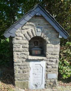
The Battle is still present everywhere in the region. In Vossenack is the Hürtgenwald 1944 museum which is maintained by the private “Historical Society Hürtgenwald in 1944 and in peace”. There are many memorials all over the place, for US soldiers as well as for Germans. One memorial is quite special: it is a memorial for a German officer donated by US soldiers.
You can follow the infamous (well sign-posted) “Kall Trail” down into the forest where many remains of the Battle are still visible today. There are two large German war cemeteries in Vossenack and Hürtgen (US soldiers were buried in cemeteries outside Germany, for example in Belgium and the Netherlands, or transferred back home).
The German veteran organization “Windhunde” (former members of the 116th Panzer Division (“Windhunde”) and their families, friends and descendants) is still very active in commemorating the Battle. They set up a large memorial next to the Vossenack cemetery, and they cooperate closely with US veterans. Each year in October there is a Remembrance Walk through the forest by US and German veterans, visitors, and citizens together with many events like an American style BBQ, meetings, and lectures.
We went to the Huertgen Forest in September, on a very sunny day, but when you walk deep down into the forest, you learn very soon that you wouldn’t want to spend an entire winter there. The forests are very steep, the ground consists of solid rocks, and the conifers forest is dense and dark.
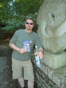
As guide books, we used the “Militärgeschichtlicher Reiseführer” by Peter Többicke and the very good “Hürtgenwald 1944/1945 Militärgeschichtlicher Tourenplaner” by Rainer Monnartz. The last book is especially good and highly recommended if you can read German because it offers complete tours with location descriptions, photos, and even GPS coordinates, which proved to be very helpful.
Huertgen Forest then…
The Battles in the Huertgen Forest took place from 14th September 1944 – 10th February 1945. The reason why the US forces entered this almost impassable and rough terrain was that they wanted to push to the Rur river and to secure the Schwammelauel Dam which was located behind the mountains. They also wanted to secure the village of Schmidt in order to capture the city of Monschau, which was a German HQ.
The US forces underestimated the presence of the German forces – they couldn’t know that the Huertgen Forest was a staging area for the Battle of the Bulge planned for December 1944. In addition, the entire wood was mined and crisscrossed by trenches, barbed wire, and fortifications. Because of the rocky and steep terrain, it was almost impossible to cross the forest with tanks or heavy equipment, but the US neglected initial reconnaissance and so the 1st Army got trapped on the rocky and muddy “Kall Trail” deep in the forests with almost useless tanks which had to be abandoned in great numbers. In hindsight, military historians agree that the Huertgen Forest should have been avoided. Charles B. MacDonald, an US historian and former company commander who served in the battle stated that this Battle was “a misconceived and basically fruitless battle”.
Due to the difficult terrain, the American advantage in numbers became irrelevant and a small number of defenders could stall the US advance for months. In addition, the winter 1944 was extremely cold with early snow and heavy mud, and the Americans were completely unprepared to fight in cold weather. They were only supplied with summer equipment and clothing – while the German veterans with their experiences in Russia and places like Stalingrad had become quite accustomed to winter warfare.
When the battle hardened US forces, which were sent in first, had been so reduced that they became combat ineffective, the US command decided not to retreat from the forest. Instead, they sent in inexperienced, green recruits, which led to even more casualties.
The US soldiers were forced to blast tank routes into the rocks which were blocking the small path along the steep slopes. Often enough, tanks lost their tank tracks or slipped down the slope or were even pushed down by soldiers when they became useless. It was quite easy for the highly mobile Germans with Panzerfausts and improvised rocket launchers to spot and attack targets and then to disappear into the woods again, while the Americans had difficulties to spot any targets at all. Due to the high trees, mortar or artillery support was also often unavailable to the US forces because of the danger of tree bursts.
The US 1st Army estimated that they were opposed by roughly 5,000 men, with almost no artillery and no tanks at their disposal, but opposing to the US belief that these Germans were weak and would retreat soon, they successfully stalled the US advance for months. In fact, they faced two full German divisions (275th and 89th), coupled with elements from the 6th Panzer Division when the 28th attacked. In addition, they had no fewer than 15 artillery battalions blanketing the area. Over the course of time, the Germans ended up throwing in 6 divisions into the battle, suffering a total of about 28,000 casualties. Control over towns like Vossenack switched about 28 times between both sides.
…and today

The villages were rebuilt from scratch after the war, there are almost no historical pre-war buildings left. This is the rebuilt church of Vossenack
While the mountainous dense forest may be a very idyllic sight today, and the area is marked as a climatic health resort, the villages in the Huertgen Forest are not very attractive.
Not much was left of Vossenack, Kommerscheidt or Schmidt after the battle, so all villages had to be cleared of mines and rebuilt from scratch. If you see these villages today, you cannot believe that you are visiting 500 years old towns – they almost exclusively consist of faceless new buildings in typical 50’s style. There are no lively village centers, old buildings, or the typical half-timbered Eifel houses (as for example in picturesque Monschau). The small Hürtgenwald villages appear very contemporary and somewhat cheerless. The fact that we entered Kommerscheidt on a Sunday afternoon, when all streets were deserted didn’t help, so we got the impression of entering a ghost town.
The surrounding National Park Eifel is a beautiful recreation area with old timber work villages, seas, old volcanoes, forests, and mountains. The closest historical towns are Monschau and Nideggen. Especially Monschau is well worth seeing and very popular among tourists from Belgium, France, and The Netherlands, so if you visit the Huertgen Forest, you should also visit Monschau, the Rur dams, and the NS Order Castle Vogelsang.
Siegfried Line
In the entire region between Aachen and Monschau, you can see the dragon teeth of the Siegfried Line (German: “Westwall”). There is even a 12 km long “Westwall Wanderweg” (“Siegfried Line hiking route”) which leads from Simmerath in the Huertgen Forest to Monschau. Here, you can walk on and along the Siegfried Line, which is a must if you are a battlefield tourist.
The dragon teeth are still intact today, simply because it is too expensive to remove the massive concrete objects. Many are situated in private gardens, front yards or along the road and fields because people simply built around them. You are kindly advised by signs not to enter private backyards and gardens when following the Siegfried Line, but there are enough dragon teeth in the open for everyone to see and touch and climb.
When we came to the Huertgen Forest, our first stop was in Lammersdorf near Simmerath where the “Westwall Wanderweg” begins. There is a small parking lot, just large enough for one car, and a wooden sign showing the direction of the Siegfried Line next to the road. You can’t miss the teeth, though – they are everywhere along the road.
More photos in our photo gallery!
We then followed the route for a while, walking on the concrete bunker constructions of the Westwall which leads through fields and along a small rivulet. The dragon teeth here are overgrown with moss and plants, but you can freely walk between them, which is quite interesting and feels weird because you begin to realize that building them was such a weird project in the first place. If you think about the endless rows of dragon teeth, hundreds of kilometers long, you cannot help but start wondering what an immense effort it must have been to build them.
Vossenack Hürtgenwald 1944 Museum

Mines are dangerous even today – before you build a house in the Huertgen Forest, you have to call a bomb disposal team to clear the ground
After returning from our walk along the Siegfried Line, we drove to Vossenack to visit the Hürtgenwald Museum. The museum is maintained by honorary volunteers and only open from March-November and only on Sundays (!) between 11 am – 5 pm, so time your visit well!
When we reached the museum, we were surprised about how lively it was, outside and inside. There were many cars in the parking lot, coming from all over Germany, Belgium, the Netherlands, and even Great Britain.
The entrance fee is moderate, 4 Euros for an adult (5 Euros if you take a guided tour, but guided tours are only offered occasionally, so we couldn’t join one). There is also a field hospital bunker which can be visited for an additional fee of 3 Euros, but since the entrance to this bunker is in the cellar of a private home, it is only open from time to time (one hour on Saturdays, I guess). The museum also offers guided military tours for schools, groups, or English tours for army personnel from other countries, but these have to be booked in advance, so it is quite difficult to get any official guide in the Hürtgenwald Museum. We explored the museum on our own.
The museum staff was very helpful, though; there was a bearded army retiree who was in charge that Sunday and he explained to us how the museum works and invited us to the annual Remembrance Walk and BBQ next weekend.
In the museum, you can watch a documentation about the Hürtgenwald in a cinema room. We watched for a few minutes and the documentation “You enter Germany – Bloody Huertgen and the Siegfried Line” was very good with lots of original footage, eyewitness reports and detailed information about the backgrounds. Since the documentation was about 90 minutes long, we then decided to buy the DVD (it was sold at the museum entrance, it is in German and English and well worth the money!) and watch it at home. If you can get your hands on a DVD, you should buy it (you can even order it from amazon.de because it is region free).
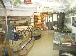
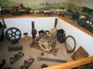
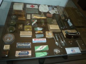
We then followed the circular route of the Museum which strongly reminded us of the Oorlogsmuseum 1944-45 in Arnhem. The museum displays findings from the area – German and US weapons, ammunition, mines, equipment. You can see uniforms and private possessions of soldiers, documents, and photographs. There are vehicles, tank tracks, parts of shot down aircraft, helmets, wall signs, and all kinds of things from the era.
The history of the battle is depicted on large wall charts with maps, everything is bi-lingual in German and English. There were many visitors from other countries, especially Americans, in the museum and the atmosphere was very open and friendly.
Visit our photo gallery for many more museum photos!
We spent about 2 hours in the museum and then we left to visit the actual battlefield.
Vossenack church and cemetery
We left our car at the museum and walked to the Parish Church St. Jozef in Vossenack. The church was completely destroyed during the battle and re-built after the war in a semi-old fashion. It is a Fatima pilgrim church containing a Madonna consecrated in Fatima and she is supposed to work miracles. Accordingly, the walls around the Madonna, who is located in the church entrance, is full with expressions of thanks by people who were helped by her in times of need. The new church bell was sponsored by the Windhunde panzer division and its chiming is meant to be a “reminder of peace”.
The church was the scenery of heavy fightings during the battles for Vossenack. On several occasion, control over the church was split in half between German and US soldiers, one faction shooting from the hall, the other from the sacristy or bell tower.
Inside the church, there is a huge colorful church window which was donated by the Windhunde division, together with a memorial plate remembering the war. On the church door, there is an inscription remembering the 68,000 Americans and Germans who were killed, wounded, fallen ill, captured, or missing in action during the fightings in and around Vossenack.
Behind the church is the church cemetery. This cemetery contains several war memorials, one directly behind the church commemorating the dead of both World Wars.
The most important and most impressive memorial is the crucifixion group in the central part of the cemetery. It is quite expressive and shows Jesus on a large crucifix who extends one arm to the desperate people below (two of them being Mary and John the Baptist). The inscription plate says: ““MEMORIAL FOR PEACE 8.5.1945 – 8.5.1985 – Remember the Dead – they’re asking for peace“. It was created by the Franciscan monk Laurentius Englisch and funded with donations.
Down the Kall trail
Following the descriptions in our guide-book, we left the cemetery through a gate at the far end. After crossing some faceless village streets, we left Vossenack and reached a small path winding through fields of corn and cow pastures. Our guidebook hinted us at a small way cross with a base perforated by bullet holes. Watch out for it, it can be easily missed!
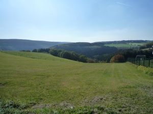
Vossenack is located on the back of a woodless hill, surrounded by pastures and fields. From the fields, you could see the dense, dark forest below which fills the steep valleys between Vossenack, Kommerscheidt, and Schmidt. On the opposing hill, separated by a deep valley filled with dense forest, you can see the village of Kommerscheidt (Schmidt isn’t visible from Vossenack). After passing some more cows, a signpost showed us the way to the forest entrance and to the Kall Trail.
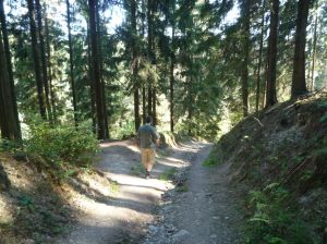
The Kall Trail (it was named by the US soldiers) is a small, steep, rocky path leading down to the small river Kall deep below in the valley. Then, after crossing the Kall, the path winds up another hill, equally steep, equally rocky, up to the village Kommerscheidt.
Beginning in November 1944, the 112th US Infantry Regiment used this trail to press on towards Schmidt, but they neglected recon and so they missed the fact that the initially broad and comfortable way at the forest entrance soon changed into a small, steep path which was almost impassable for heavy equipment and tanks (it is even difficult to walk down there on foot). The US soldiers were stalled on the path and only with greatest efforts, they managed to move at least some tanks and equipment down into the valley and across the Kall river. For the Germans, these efforts could be easily disturbed with small ambushes and constant hit-and-run attacks.
The path soon became so narrow that engineers had to blast away massive rocks which blocked the way down. The blasted-off blocks of rocks are still visible between the trees below the path today.
In addition, the path was very muddy and it became impossible for the tanks to turn around on their axle, so driving along a curve was highly dangerous. Driving forwards and backwards in order to maneuver around a curve led to the destruction of armor tracks. In the end, many broken tanks were simply pushed down the steep slope to the left of the Kall trail, where they ended as wrecks.
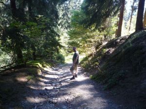
Walking down the path is difficult and exhausting even today, in sunny, dry weather and without enemy fire, and the path is so steep and narrow that we had difficulties to imagine how tanks were moved downwards at all – in the winter, in the mud (and later snow) and with rocks blocking the way. Walking down the original path was very illuminating indeed and is highly recommended because you will get a quite lively impression of the difficulties the Americans faced in 1944. Watch out, though – the rocky path is quite difficult to walk and you need good shoes with a good grip if you plan to follow the Kall Trail.
If you are handicapped, there is also an “easy way” down to the Kall river today, a paved road from Vossenack which leads to a popular tourist attraction next to the river Kall, the Mengener Mühle (Mengener Mill) where you can eat and drink, but fortunately, the original Kall trail is still intact and in original shape as it was in 1944.
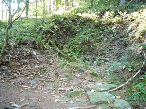
Halfway down the trail, our guide-book brought a point of interest to our attention which could be easily missed: a foxhole, several meters up the steep slope to the right of the trail. We climbed up the slope and discovered the hole which was hidden among trees. A small wooden remembrance cross – the same type of crosses we saw everywhere across Arnhem – was left next to the place. This foxhole was originally hidden under a tarp and heavy logs which protected it from the air bursts. It served as an US field hospital where wounded from both sides were treated. Sometimes, German and US medics worked side by side. This aid station was left alone by the German Army during the battle after they had checked out that the US medics were unarmed.
Following the Kall Trail down, we crossed the new paved road several times where wanderers, mostly families with buggies, were on their way to the Mengener Mühle. From time to time, we met other battlefield tourists from several countries, which could easily be recognized by the Hürtgenwald books or maps they held in their hands.
After a while, we were down at the deepest part of the Kall valley, several hundred meters below our starting point. Next to the river, we could see the Mengener Mühle, which had changed ownership during the war several times. It had served as a German and US HQ, field hospital, and supply station. We didn’t visit the Mühle, but continued to follow the Kall Trail to the famous bridge.
Kall bridge
The Kall stone bridge was built by US forces who needed this bridge to move their tanks over the small river. The original bridge was destroyed during the war and rebuilt after the war.
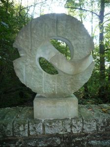
In November 2004, a memorial was placed on the massive bridge railing: “A Time for Healing”, together with an information board in English and German. The information board describes the historical events which took place on this bridge from November 7 to 12 in 1944. Here, German regimental doctor Captain Dr. Stüttgen managed to negotiate an inofficial ceasefire with the US forces to treat all wounded from both sides at the bridge. During the armistice, German paramedics took care of all German and US wounded soldiers on and around the bridge.
After the war, Dr. Stüttgen was honored by the Governor of Pennsylvania. A painting of the event called “A Time for Healing” can be seen in the Museum of the National Guard. A copy of the painting is in the Vossenack museum.
Up the Kall trail
After crossing the Kall bridge, we followed the Kall trail up the next hill which leads to the village of Kommerscheidt. The way is as steep and rocky as the way down and quite exhausting.
Half way up is another point of interest: US armor tracks, melted into the road. In this place, three trapped US tanks were destroyed by the Germans. The German soldiers were very happy when they discovered that the tanks were full of supplies: field rations, chocolate, cigarettes, cookies, and meat cans. One soldier, a young company runner who became friends with his US counterparts after the war, remembered that they discovered a tin with unknown stuff inside… which tasted quite good. After the war he learned that this were crunched peanuts and when he met the US soldiers on a veteran meeting for the first time, the tank commander brought him a box of peanuts as a present – something he never forgot.
On top of the hill, near the village Kommerscheidt and next to a mountain shelter, is an overlook with a small bank, perfect for taking a break. Here, you have a perfect view over the Kall valley and the dense forests between the treeless hills.
Kommerscheidt
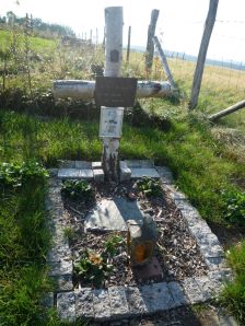
At the entrance to the village Kommerscheidt is the grave of US Staff Sergeant Lemuel H Herbert. The grave is decorated with a cross and a photo, but it is empty today because Herbert’s body was transferred to the US after the war. Still, the grave is well-kept and serves as a memorial today.
We entered the village of Kommerscheidt and were somewhat underwhelmed. This isn’t Kommerscheidt’s fault, of course, the village is about 600 years old, but it was the site of a heavy tank battle and almost nothing was left from the original village. Today, it is another faceless, 50’s style village without a city center or anything of interest – besides large single-family homes. We came to the conclusion that building a house in the Hürtgenwald must be quite cheap because all houses are somewhat oversized and built in weird villa or mediterranean styles, together with large properties and gardens. Since the area is still mined and you have to check for explosives before building a house, the Hürtgen Forest appears to be a popular living place or satellite suburb for commuters or young families without much income who work in the cities of Aachen, Düren or Nideggen, where property is much more expensive.
Unfortunately, we were under the wrong impression that the tour we had picked from our guide-book was a circular tour – in Kommerscheidt, we discovered that our tour ended with a description of the tank battle. So we realized that we were trapped in Kommerscheidt – our car was still in the parking lot in Vossenack, which was located on the next hill. We had a direct LOS to the village, but – historically accurate – we were separated from our destination by a valley filled with dense forest and a steep Kall trail…
We decided to check for a bus back to Vossenack, but the first problem was that there were no natives anywhere… the streets were deserted, apart from another couple with a Hürtgenwald guide-book, who looked as lost as we did. We walked up the main street and discovered a young girl who stared as us with surprised eyes. When we asked here for the next bus stop, she was quite confused and stammered something about her school bus. We then discovered the bus stop in front of the only (closed) pub in Kommerscheidt and had to learn that there are two busses a day, destination Schmidt, and the last bus left hours ago.
There was only one choice left: We had to walk back the entire Kall Trail to Vossenack, down to the river and up the rocky, steep slope to Vossenack…
Vossenack War Cemetery
It was 5 pm when we reached the parking lot and the museum (which was closed by then). It was too late to visit the Ochsenkopf, another valley filled with dense forest, and to visit the memorials and bunkers which are located there. We decided to visit at least the two war cemeteries before dusk.
The Vossenack War Cemetery is located outside Vossenack on the strategically important “Hill 470”. This hill was the scenery of heavy fightings and changed ownership several times during the war. There is a lookout next to the road where you have a great view over Vossenack and, if weather permits, you can see as far as the area around Cologne.
The cemetery contains the remains of 2347 Germans. 100 of them are members of bomb disposal teams who died after the war when defusing mines and explosives.
This cemetery has a very special history. German Captain Julius Erasmus went to the Huertgen Forest after the war, after he had lost his entire family in the Battle for Aachen, and was shocked by the bodies of dead soldiers lying around everywhere in the woods. It preyed on his mind, so he began to identify and bury them by himself, searching the burning woods and active minefields for bodies and burying them near the forest edge. When he had buried 120 dead soldiers, the village of Vossenack allowed him to use the village cemetery.
In the end, Julius Erasmus (who soon went by the name “Totengräber von Vossenack” = “Grave-Digger of Vossenack”) had buried 1569 dead soldiers on his own. He wrote down the names and dates of the dead, drew maps of their burial places and marked all graves with simple wooden crosses.
In 1949, the war cemetery Vossenack was built on Hill 270 and all dead German soldiers were transferred there. The administration of Vossenack offered Erasmus a house in the town, but he preferred to remain in his small wooden hut in the forest, close to the cemetery. He died in 1971. A memorial at the cemetery entrance commemorates his work.
Many soldiers in this cemetery were never identified, so the inscription on their gravestones is simply “Unknown soldier”.
In front of the cemetery is a parking lot. From there, we first went to the “Windhunde Memorial” next to the cemetery. The 116th Windhunde Panzer Division installed a monument with the inscription “Tote Soldaten sind niemals allein, denn immer werden treue Kameraden bei ihnen sein” (“Dead soldiers are never alone because their comrades will always be with them“). Information boards next to the memorial tell the story of the 116th Division with photos and text (which is, unfortunately, written in German only).
The graves on the Vossenack war cemetery are marked with simple stone plates on the grounds. Two soldiers share a grave and a stone. The most prominent person buried on this cemetery is Generalfeldmarschall Walter Model who committed suicide in April 1945 (still convinced of the superiority of National Socialism).
The atmosphere on the cemetery was quite peaceful but somewhat grim, due to the heavy black basaltic stones which were used for the crosses and for the central memorial.
Hürtgen War Cemetery
We then drove to the War Cemetery near the village of Hürtgen. It was built on the largest minefield in the entire Hürtgen region, named “Wilde Sau” (wild sow). The cemetery contains the remains of 3001 dead, among them 2925 German soldiers, 35 civilians, 27 Russians, 13 Polish, and 1 Belgian. 560 dead are still unidentified.
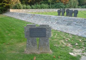
The shell limestone gravestones on this cemetery are quite remarkable: They are built as so-called “comrade-gravestones”, consisting of two adjoined crosses each.
At the entrance is a memorial for German Lt. Friedrich Lengfeld, sponsored by veterans of the US 4th Inf. Division in 1994. On November 12, 1944 Lt. Lengfeld tried to rescue an American soldier who was laying wounded in the Wilde Sau minefield and was crying for help. In his attempt to rescue the American soldier, Lengfeld was also severely wounded and died shortly after.
The cemetery is not as symmetric as other cemeteries, but is built inside an idyllic little forest with curved rows of crosses. When we left the cemetery, it was getting dark already.
There is still much to discover in the Huertgen Forest, for example bunkers, the village Schmidt, and the Ochsenkopf valley where several US and German memorials are placed deep inside the forest. So one day, we will certainly visit the Huertgen Forest again!
Visiting this battlefield was very interesting and the battle is still very present everywhere in the forests and villages. You have to plan your trip carefully, though, if you want to visit the Vossenack museum which is only open on Sundays from Spring to Autumn, and you need a good guide-book and maps if you want to find all hidden places and memorials (or a local guide, which is even better!).
With some preparation, a trip to the Huertgen Forest will be a very impressive and vivid experience!
And don’t forget to visit our photo gallery with many more photos from this great trip!

















Dennis M.Quinn said
My father was in the 83rd ID, 330th Infantry as a 1st Lt. ( battlefield commissioned). He was transferred from Luxembourg in Dec. ‘44 just before the German attack through the Ardennes. He was already wounded in France in July that year and returned. He never spoke much about the Huertgen campaign other than the bitter cold and the artillery tree bursts. He eventually made it to the Elbe river at the war’s end.
chuck dewire said
I would like to tour the area that the 9th ID was in during the month of September 1944. My grandfather was wounded September 24 near Lammorsdorf. Can anyone provide me names of and contact information of people that conduct tours of that area.
Andreas Ludwig said
Hi Chuck,
Zeitreisen-Eifel are conducting guided tours of the area and there is in fact a tour around Lammersdorf as well so that may be particularly interesting for you.
Check it out here: http://www.zeitreisen-eifel.de/index.php?id=63
Contact via email is: infoATeifel-tipp.de
I don’t know if the guided tours are also available in English, though so you better get in contact with them to be sure.
Andreas
Doug Mitchell said
The Zeitreisen are good, but hew to a specific route and schedule every time. If you’re interested in an in-depth look at 9th ID and their role in VII Corps’ initial press into the Westwall in September, I’ve supported several family groups and individuals related to 9ID during their adventures here in Europe, as well as military field studies covering their campaign. Took the family of a 9ID (60IR) soldier KIA in the Hürtgen (buried at Henri Chapelle) back to the site of his last firefight in 2017. Feel free to drop me a line at . I’m a former Marine living in a former recon command post directly on the Bulge front lines. For a look at how I roll, you can check out the numerous photo galleries of my field recon and private tours posted to Facebook : https://www.facebook.com/doug.mitchell.399488
Doug Mitchell said
Contact : doug dot mitchell at t-online dot de
Mr site stevens said
Visited the area in July, we followed most of what you wrote about,it was very informative. Thank you. Made our trip to the hurtgen very interesting as we reenact the 4th infantry. Very emotional.
Steven Foremaster said
Has the location of the “Wild Sow” (“Wilde Sau”) minefield been established?
Anonymous said
Here’s a doubly useful link, directly answering your question and providing a future resource for answering other site-related battlefield questions :
http://en.tracesofwar.com/article/51094/Westwall—Former-Minefield-Wilde-Sau.htm
This second link provides more specifics :
http://wikimapia.org/33538493/Minefield-Wilde-Sau
Richard Beaumont said
I will be visiting the Hurtgen Forest in Sept. 2016. My uncle, whom I am named after, fought with the 9th Infantry Division, 60th Infantry regiment, Company F. He went in at the start of the battle in Sept. 1944 and his unit was evacuated due to high casualties in late October. He won the Bronze Star for his actions which I now have..he passed away 2 years ago. I made a promise to him that I would visit where he fought. He mentioned the towns of Monschau, Duren, Hofen, Germeter, and Alzen. I would love to hire a guide for Sept. 24, 2016 to navigate this area where my Uncle’s Division fought. Can anybody help me? Thanks Richard Beaumont
Doug Mitchell said
Richard… Doug Mitchell here, a professional battlefield guide in the region. Full-time American ex-pat, former USMC, currently renovating the wife’s ancestral family farm into a B&B for folks such as yourselves. We’ve hosted numerous vets & family over the years. Know a great deal about the Allied border campaigns between Sept. ’44 & Mar. ’45 (I live in a former 106th ID during the Bulge). In addition, I’m well connected with local experts in the border regions from the Alsace up to Market Garden. I can get you straight to the real story in the Hürtgenwald — and anywhere else you may have in mind. Drop me a line at doug dot mitchell at t-online dot de for a consult.
Harry D Stumpf said
My name is Harry D. Stumpf. I heard about a Hurtgen Memorial weekend taking place the last weekend in September 2016 from Yuri Beckers, the webmaster for the 9th Infantry Division website, who is currently travelling. I would like to make a train reservation now from Brest, France, to the event but don’t know the exact time or place. My dad was with the 39th Infantry Regt of 9ID. Can you help me find specifics on the Hurtgen Memorial weekend please?
Denny Koch said
Hello Harry, I tried to find out more about the mentioned Huertgen Memorial weekend, but I didn’t find anything. The local websites of Vossenack and the other Huertgenwald communities offer some guided hiking tours at the end of September (for example, following the Kall trail), but there is no information about a Memorial weekend. Do you have any additional information (for example, in which village the event is taking place or who organizes it?).
Best regards,
Denny
Doug Mitchell said
Just a follow up comment to answer the open question : Harry DID find the memorial event (hey Harry), known informally as the “Sons & Daughters” weekend, and organized by a small group of my German colleagues. The primary organizer is a fellow named Albert Trostorf, recently recognized by the US Ambassador for his many years of service to the history of the Hürtgen campaigns, as well as Stolberg, Aachen and anywhere 1st ID (in particular) fought during WWII. In fact, I’m producing Sunday’s program in 2017, working with my fellow officer in the 106th Infantry Div. Assoc., Belgian Carl Wouters to show this year’s group what happened to the youngest (and most isolated) American division in the Bulge : The Golden Lions. Turns out, Harry’s also related to a high-ranking officer who served with the 106th for a time…
Cheryl Hildebrand said
Hello! My father was in the 5th infantry and was wounded in Dudeldorf on March 4, 1945. My brother, husband and I are traveling to the area to try and trace his path as closely as we can. As both my parents are gone, we are trying to research more about the exact areas my Dad was at – as he was an officer, we actually have his map of the area and we are trying to decifer what the notations mean. I would love to have more information on the possibility of hiring a guide for our two days in the area, November 26 and 27th of this year. Please contact me with any information you can share and availability of guides etc to my email, chricheryl@aol.com or my brother at snels49@msn.com. Thank you!
Doug Mitchell said
Hello Cheryl — didn’t spot your query above until now (Feb. ’17), but I’m dropping you a quick line by e-mail anyway, just in case…
Andrew said
Anyone know anything about the 2nd Ranger battalion, they were with the 8th infinity?
My father was wounded twice there but he refused to go home and went back to the front lines to find his men because they were getting wiped out and it is amazing that he lived through that and that is why he is my hero and I am sure that you all have the same kind of story of your fathers. That is why America was great, but it doesn’t have people like them anymore and that is why we are a failing nation and I don’t have any hope in the youth at all….I am dying trying, its all I have left to do the right thing and honor my father and all of your loved ones….United We Stand, God bless America
John Duzac said
That is so right Andrew. My father was there too. He went through the entire Battle of the Bulge and was badly wounded about two weeks before it ended. Dad spent 10 months in a hospital in England. Had when home and raised two sons. Sadly, dad passed away with Pancreatic Cancer on January 29,2015. Two months before he died, he was awarded a 100% disability from the VA.
John said
Andrew, your father sounds pretty amazing and you should be very proud of what he and his Soldiers accomplished. However, I would head caution when making statements about “we don’t have people like that anymore.” This current generation of Soldiers, sailors, Marines and Airmen have been at 15 years of continuous war! Now everyone in the military is a warfighter, but I can assure you that the still are those that fight and sacrifice just as much as any of those from any past war. I can personally attest to this as I carry more names on my wrist-bracelet than I care to think about and have spent my fair share of countless months in the mountains and deserts of our current conflicts. Our great nation is only faltering due to sad-state of affairs of our politicians that call themselves leaders. And while I myself question the competency of this very youngest of generations with the “safe-zones” and cyber-bullying, I would argue that any such problems could be fixed if the OLDER generations helped LEAD the younger ones.
Doug Mitchell said
2nd Rangers were the “hired guns” brought in to deal with the heavily fortified hilltop at the eastern end of Bergstein (above the northern end of the lower Kall valley) known to the Amercans as “Hill 400”. There’s a marvelous viewing tower there today, with great views westward back into the southern edge of the Hürtgen campaign area.
Janine Miller said
I wonder if Kall Bridge is what my dad talked about. He was in the Hurtken Forest battle, and said they Germans allowed wounded Americans to leave, and that no one wanted to lead them out, so he got up and started for a bridge. He had to pass a German soldier, who allowed him to pass. Others took courage and followed. By the time he got to the bridge, he wasn’t leading anymore, bc they had mostly overtaken him. One of his wounds was in his leg. So, this must be the bridge, unless there were any others around at the time. I never knew quite how to picture it when he told his war stories to us. He is gone, now, or I would have more questions for him, for sure.
Janine Miller said
I forgot to mention he was captured, and it had to do with the Germans not wanting to deal with the wounded, so they let them go.
Doug Mitchell said
Janine, he was most definitely describing the Kall Bridge. The fighting down in the valley between Vossenack and Kommerscheidt was bloody and difficult, and a ceasefire was organized so both sides could collect the wounded and deceased. A nice summary is actually included in the article atop this page :
“The Kall stone bridge was built by US forces who needed this bridge to move their tanks over the small river. The original bridge was destroyed during the war and rebuilt after the war.
In November 2004, a memorial was placed on the massive bridge railing: “A Time for Healing”, together with an information board in English and German. The information board describes the historical events which took place on this bridge from November 7 to 12 in 1944. Here, German regimental doctor Captain Dr. Stüttgen managed to negotiate an inofficial ceasefire with the US forces to treat all wounded from both sides at the bridge. During the armistice, German paramedics took care of all German and US wounded soldiers on and around the bridge.
After the war, Dr. Stüttgen was honored by the Governor of Pennsylvania. A painting of the event called “A Time for Healing” can be seen in the Museum of the National Guard. A copy of the painting is in the Vossenack museum.”
Roberta Conroy said
My father was a Lt. in the Army 4th Infantry division and never got over losing men and shooting at young German boys. Hurtgen Forest was brutal. 200% mortality for 4th Infantry? In my professional life, I became friends with a German Deutsche Bank exec and we learned that our fathers were in the same battle at Hurtgen.. but I believe his father was a very senior Nazi officer–he didn’t want to talk but one has the same name. My dad landed at Utah.. but the current put them in the wrong place but they figured it out. His most powerful story for me was that he came to the main camp at Dachau (after liberating at least one subcamp) a day after it was evacuated. He said he could smell it and as they arrived the German soldiers fled into the trees but left the German Shepherds charging the fence at the Americans. They had to shoot all the working dogs and this disturbed my dad. . Kid lesson: Not all dogs the same, be careful. Recommend reading If you Survive by George WIlson. A link to this book and others: http://lions44.hubpages.com/hub/BestWWIIMemoirs
Doug Mitchell said
4ID were here in my neighborhood both before and after their turn in the Hürtgen — in fact, they liberated my tiny German border village of Großlangenfeld (ß=ss) on 12 Sep. ’44. The second time was at the tail end of the reduction of the Bulge, when 4ID & 90ID pressed the Germans back into Germany in this area. Interesting factoid, since these two specific American infantry divisions were also first ashore at UTAH on D-Day. If you’re ever headed to Europe with an interest in exploring 4th’s campaign, feel free to drop me a line.
Karl Metz said
Denny thank you so much for this interesting journey.I will be visiting this soon and you gave some good information.I am from the Netherlands with German roots and moved to the Eifel a year ago.Although I served the Dutch royal Marine corps for 23 years my family had its history in the Wehrmacht.My Granddad never came back from the Eastern front and I feel proud to say that I made it as first in my family after the great war to be back in military again.I always had the strong need to search and discover about the WW2 history and in particularly the battle of the bulge…I guess my military past will let me watch very carefuly when I walk the trail
Denny Koch said
Karl, thank you very much for your feedback! You have quite a biography, very interesting!
The Eifel is a great place to live and travel, we travel there a lot, since there are not only interesting WWII locations, but also many ancient Roman sites, like temples, villas, and industrial sites like aquaeducts and quarries (Ancient Rome is our second great passion besides wargaming 🙂 )
I’m glad our Huertgenwald travel report was useful for you! When you go to Vossenack, remember to visit the place on a Sunday because that’s the only day of the week the museum is open to the public. If you can read German, you should also take Rainer Monnartz’ tour guide “Hürtgenwald 1944/45” with you, it’s a good book which offers some suggestions for short and long tours through the area.
Since you are interested in the Battle of the Bulge, we also travelled the Ardennes extensively. Did you discover our two Battle of the Bulge travel reports yet? (Part I about Luxembourg and the Eastern Ardennes, Part II about Bastogne and the Western Ardennes). If you are interested in this battle, we highly recommend visiting Luxembourg (which is also comfortably close to the Eifel!).
Enjoy walking the Kall trail, I’m sure that your military background will reveal more information to you than to the average hiker. There is a lot to discover left and right from the track!
Karl said
Sorry for the late response back Denny.Had computer problems and work also took a lot fro my time.I bought a house in Spangdahlem which near a US Air Force base.Anyway,I now live in Baustert only 15km from Luxembourg.I lived in belgium for some time during my service and saw a lot there already.But as the battle of the Bulge came forth out of the West wall offensive I guess this is the next part in reseaching ww2.I am going this Saterday for the first time.I made a plan what I want to visit first.Next time another part..for me it is only 80 km drive so not to far.Checklist ready for things I will need.I will look for the book.My german is good so that will not be a problem.Denny if you ever are back in the Eifel then let me know.You are always welcome and maybe we can look for some things..I know spots in Bitburg which leads back to the Roman empire..also Templars has my interest so I bet we would have some fun..
Doug Mitchell said
Are you still living here in the region, Karl? Curious, did you visit the Friedhof (with Kriegsgraberstatte) in Bleialf in 2016? My Eifel wife crossed paths with a Dutch fellow much like yourself who was there while trying to reack down a relation in late summer 2016.
Larry said
Denny would this hike down and back on the Kall Trail be too much for 4 guys in their advanced middle age years in ok shape but w/ back problems? What is total hike time with stops to view artifacts included. We will be in the area in late Sept this year. Thanks for any advise.
Denny Koch said
Hi Larry!
Some parts of the Kall trail are quite steep and rocky (especially the first part down from Vossenack to the river), most are moderate or unproblematic (in the river bed and the way up to Kommerscheid).
I would suggest hiking down on dry weather, since the steep parts will be slippery and muddy after the rain. In any case, you should wear hiking boots with a good profile. The worst part can be skipped by using the road along the Kall river, but that would rob you of the authentic experience of following an incredibly rough path and wondering how it was ever possible to traverse it with tanks. In addition, you can find medic foxholes in the woods along the steep parts of the trail, so you should definitely try to follow it.
I cannot judge how back (or knee) problems will impair you on the more difficult parts of the trail, but the worst parts are not too long and if you go slow and take it easy, it’s manageable. It’s not alpine or anything, just a narrow, slippery, steep path through a dense forest.
Using a guide book is also highly recommended, or you could overlook some of the sights hidden in the forest (if you can read German, I highly recommend “Hürtgenwald 1944/1945” by Rainer Monnartz with tour recommendations and good descriptions.
You should also keep in mind that the Hürtgenwald museum in Vossenack is open only on Sundays. Before starting down the Kall trail, visiting this museum is highly recommended, it’s well worth seeing!
All in all, if you go slow, watch out for sights, stop at the info boards, and enjoy the surroundings, the Kall trail will take about 4-5 hours from Vossenack to Kommerscheid (2 if you walk straight and fast, as we did on our way back).
I hope you will have a great time and an enjoyable visit!
Denny
George B said
My father Jean B. Beaumont was in the Huertgen Forest with the US 8th Infantry (Pathfinder) Division, Company C. At one point they were pinned down by artillery fire (leveled all the trees), and he passed out from the cold and shelling in a foxhole. He was removed from action for a time and then returned to combat. Eventually made it to the outskirts of Berlin, I think. Most of the small towns were completely blasted. He always remembered his buddies that didn’t make it out of the meat grinder.
George B.
Denise said
My father was also in the Huertgen Forest w/the US 8th Infantry Div., Company C, 1st Medical Battalion. He was a medic. His name was Glenn C. Jones, or “Doc”, and was originally from Kansas. Most of what I have learned has been through family members, reading and research, as he would never talk about his experiences in WWII. I believe he was also removed from action once, injured by shrapnel once, and briefly captured once. He landed at Normandy on July 3rd or 4th, 1944. Did you know the 8th liberated the concentration camp at Wobbelin ?
Just thought I would share.
Denise J. C.
Andreas Ludwig said
Thank you Denise (and George of course – just saw his comment, WP didn’t send me a notification or I missed it) for reading and commenting on our article. We are always glad if folks find our tour reports interesting enough to comment on 🙂 This is a wonderful way in our opinion that we can all learn and grow, we are all bound together due to the experiences of our fathers and/or grandfathers – even more so because we all were once ‘the enemy’. Luckily these days are over…
Antony said
On the topic of “The reason why this region and the Battle of Huertgen Forst are almost unknown to the average German citizen is…”, I live about 50 miles from Colditz Castle. And none of my German neighbours had heard of it. They were amazed when I told them how well known it was in the UK.
Andreas Ludwig said
The problem is that in Germany many people are just not interested in history, it is what it is…
Manfred Gerten said
Yes, correct, in German Schools after 1945 no history about the past, only the future.
Denny Koch said
Quote: Eric Harmon
“May 3, 2013 at 5:28 am
Your sight on the Hurtgen Forest is great but I would recommend a few corrections. The German strength was far more than 5,000 men. US forces believed that was their strength but in reality it was two full division (275th and 89th) coupled with the 6th Panzer Division when the 28th attacked. They had no fewer than 15 artillery battalions blanketing the area. The Germans ended up throwing in 6 divisions suffering a total of about 28,000 casualties.”
Eric, thank you for you reading and for leaving your really helpful comment! I integrated the information into the article – hopefully, I now got the numbers right!
Best regards, Denny
Susan Horton said
My father in law was hurt on October 11, 1944. Could you tell me where I could get more info on the October remembrance activities. Thank you.
Denny Koch said
Hi Susan, thanks for visiting our website! If you want more information on the annual October remembrance activities, you can visit the website of the “International Huertgenwald Marsch” webite here (available in German and English!): http://www.huertgenwaldmarsch.de/lkdo/index.php/en
JU said
Hey Guys,
I’m living near Düren and would like to show and walk with you in the Hürtgenwald. If you are interested you can reach me via mail judueren@web.de
best regards =)
EJ said
JU–I was in the area with the Band of Gamers trip three weeks ago. We stayed in Simonskall, which has the remains of a bunker a short walk from our hotel.
Should we return on a future trip, I will try to contact you.
Michael said
I enjoyed reading the article and found it to be one of the most indepth, detailed accounts of the Huertgen Wald today. Are any of these sites, or other Westwall locations easily accessible by train? I’m currently living in Germany (Duesseldorf) on an academic exchange and would love to visit these locations. Unfortunately I don’t have access to a car. Thanks in advance for any help you can offer.
Denny Koch said
Visiting the Huertgenwald with public transport is very difficult. The closest train station is the city of Düren, from there you have to take a bus to reach Vossenack. It’s very easy to get to Düren from Düsseldorf, but from there, things get complicated.
There is a regular bus line from Düren to Vossenack (286), but the Hürtgenwald Museum in Vossenack (which is a must see if you want to tour the Hürtgenwald) is only open on Sundays (11-5), and unfortunately, the bus rides only twice a day on Sundays… which would result in quite an odyssey.
I would highly recommend spending a night in the area, for example get to Vossenack on Saturday and spend the Sunday visiting the museum and walking the Kall trail. The Kall trail is easily reached from Vossenack, it’s only a short walk from the museum and the village center (and Vossenack is a very small village!).
You can find the bus hours here:
Click to access Busverbindung%20Linie%20286%20%20D%C3%BCren-Vossenack-D%C3%BCrener.pdf
The Hürtgenwald museum is only open from March till the end of November, so you should also consider making your trip in Spring or Summer.
And, to be honest, I have no idea how to visit the Siegfried Line with public transport. The area around Simonskall, between Monschau and the Hürtgenwald is veeeery rural.
McGowan said
Folks 1 thing about the Famous Kall Bridge.Its a very small bridge you cant really call it a bridge,And i still dont understand what was so special about it.My Family and i visit the Hurtgen region almost every 4 weeks,Due to its beauty.
My children love to play in the kall by the bridge,and its only a few Centimeters deep,And its not a River as people call it, its just a small stream.soldiers and tanks could of crossed it without using the so called bridge.But the entire region is a beautiful place to be.But also the Hurtgen forest itself is Enormous.you also have some small bridges there at the Weisser wehe and Roter Wehe.(Death Valley by Paul Boesch).
Another great place is 1,5 mile NE of Lammersdorf the Buhlert forest you will find over 30 Pillboxes(Bunkers) and alot of foxholes,And if lucky you can find some M1 Garand clips and other Ammo.I have found many war relics in and around the Hurtgen forest,with a Metal detector ofcourse.
But be carefull when moving away from the footpaths and into the forest,Even without a metal detector you can find live ammo,And shells.
For those that have seen the movie When trumpets fade the movie is good but dont expect much on the Kall trail,You wont find a large bridge and a wide river, but other thing are still visible on the Kall Trail.
For me the Hurtgen is the place to be if you are interested in WW2.But now many years later the entire region is breath taking.I also forgot to Mention Hill 400 outside Bergstein Another great hill to visit and 2 bunkers.
PS for those Metal detecting You will have your hands full by clearing Bomb frags the entire forest in scatterd with it,And sometimes it can piss u off!
I do respect those that died in the forest,And i always leave things tidy.Back in 2009 i recoverd a German soldier and he was re-buried with full honours at a cemetary near Germeter.And that did me good.
Andreas Ludwig said
Yes, the area is an interesting one and just impressive nature. The problem with tanks and soldiers crossing the river, even if not really deep, is the fact that it’s difficult terrain and there’s not much room to maneuver so a bridge no matter how small was certainly helpful. And we shouldn’t forget it was not the way we experience the Kall trail now in peace and sunshine, the weather was harsh and the area was heavily shelled by German arty and friendly fire alike. No tree in that area is older than 50 years…
Robert Kall said
Do you know why the trail, the bridge most every thing has the name ” KALL ” ?
Denny Koch said
Hi Robert,
yes, “Kall” is the name of the river within the deep valley in the Huertgen forest. The valley is also called “Kalltal” (Kall valley), and so the bridge crossing the river is named the Kall bridge – Bridge over the river Kall.
The river Kall originates in Belgium, close to the city of Monschau, and is a sidearm of the river Rur (Dutch: Roer).
Do you have any ideas where your name comes from?
Best regards,
Denny
Jim Pappas said
Denny,
Thanks for posting this, it’s great. I made a whirlwind tour throught the Huertgen back in the early 90’s. I wanted to see some of the areas my Dad went through during the war. He was part of the 298th Engineer Combat Bn, and he spent way too much time in the Huertgen. At least he survived, and is still with us today.
If I ever make it back there I definitely want to see the museum. You’re right about the dragons teeth, pillboxes, and bunkers. You still see them everywhere. It’s kind of weird to see an old bunker being used for farm equipment storage.
Bob said
Jim,
My name is Bob Kipke. My father served with the 298th Engineer Combat Bn and I’ve built a website based on the units own publication, “The 298th Engineer Combat Battalion in Europe”. Over a number of years I’ve added queries and comments from other folks with connections to the unit. I just recently added the Official Journals of the unit. I try and add anything that has a distinctive connection to the unit.
Main
http://freepages.genealogy.rootsweb.ancestry.com/~kipke/298army/298th1.htm
Query
http://freepages.genealogy.rootsweb.ancestry.com/~kipke/298army/298connect.html
Journals
http://freepages.genealogy.rootsweb.ancestry.com/~kipke/298army/298journal/298th_journal.html
I’m always interested adding anything related to the 298th if your interested in adding anything (e.g., bio, photos, queries, etc.)
Anonymous said
Hi Bob,
I’ve been looking through your web site, it’s great! I will show it to my Dad, and I’ll get some info to send to you.
Anonymous said
Please respond to my personal e-mail address posted on my website.
Thanks
CF said
Please review the use of the terms, “Siegfried Line” and “West Wall.” The former never existed during WW2, and the latter was mostly dismantled by the time of the Rhineland battles.
Denny Koch said
@CF, for a “dismantled” installation, the Westwall is quite present all over Western Germany today. You can clearly follow the bunkers, dragon teeth, and walls from the Dutch border, up in the North (Niederrhein Region near Kleve) down along Aachen, Monschau into the far South to the France border. In some regions, the installations are overgrown and quite integrated into the landscape, in gardens and fields, so you have to know where to look.
In other places, you can clearly see and visit large areas where the Westwall is still very present and in perfect shape. Some parts in the Rhineland may have been dismantled, but the major part of the Westwall still exists and will exist in the future, simply because it is too expensive to remove the Höcker and bunkers. Locals learned to live with it and to integrate it into the landscape.
If you want to get an idea, I can give you the directions to the most interesting and impressing locations, so you can undertake a Westwall sightseeing tour.
Regarding the use of the term “Siegfried Line”, I simply used it as a colloquial synonyme for the Westwall which is widely in use and known among wargamers, so I’m sure our readers know what I was talking about.
Thanks for reading,
Denny
Anonymous said
Below is a direct quote from “THE HISTORY OF THE 298TH ENGINEER COMBAT BATTALION IN EUROPE JUNE 9, 1944 – MAY 8, 1945”
“The mission of both companies was to occupy pillboxes in the Siegfried line to prevent the Germans from entering them.”